July 2, 2021
This has got to be one of the most fun days I’ve spent in the mountains in a long time – and that’s saying a LOT since I really, really enjoy being in the mountains. This was the perfect storm of a route I’d dreamed up, three great friends who trusted me to lead it (despite never being in the area before), and absolutely gorgeous weather for stunning views. I actually put off writing this trip report because I wasn’t sure I could capture what a fantastic day we had.
The first time I was in the Sibbald area was last spring when I hiked Cox Hill. From the summit, I looked across at a range of mountains I had honestly never seen before. I went home and started doing some research. I put together a traverse that would take in Belmore Browne Peak, Boundary Peak and Boundary Ridge.

Gear
Hiking boots, poles and your regular day pack kit. I’d also bring bear spray and make lots of noise. It’s not that popular of an area (we only saw one other person all day), and there is quite a bit of forest walk on either end.
Overview
Stash one vehicle at the Lusk Pass trailhead. Drive to the Belmore Browne trailhead. Follow the logging road to the start of the trail. The trail leads to a creek bed, that you hike up until almost at the start of the gully. Turn right, and start gaining elevation, heading towards the ridge on the right side of Belmore Browne. The ridge leads to the summit. From Belmore Brown, hike to the Bump, then turn right to continue towards Boundary Peak. Hike down from Boundary Peak towards Boundary Ridge, looking for the low point that leads off the ridge. Hike down to the meadow below, looking for the big cairn. This marks the spot to turn right and enter the forest, hooking up with the Boundary Ridge Trail. Follow this trail down to the valley, crossing the creek several times near the end. At the T intersection, turn right onto Lusk Pass Trail. It’s about another kilometer until you reach the trailhead and your stashed vehicle.
Parking and Trail Head
As this is a traverse, we needed two cars. We dropped off one car at the exit point – Lusk Pass Trail – then drove to the Belmore Brown / Tiara Peak trailhead.
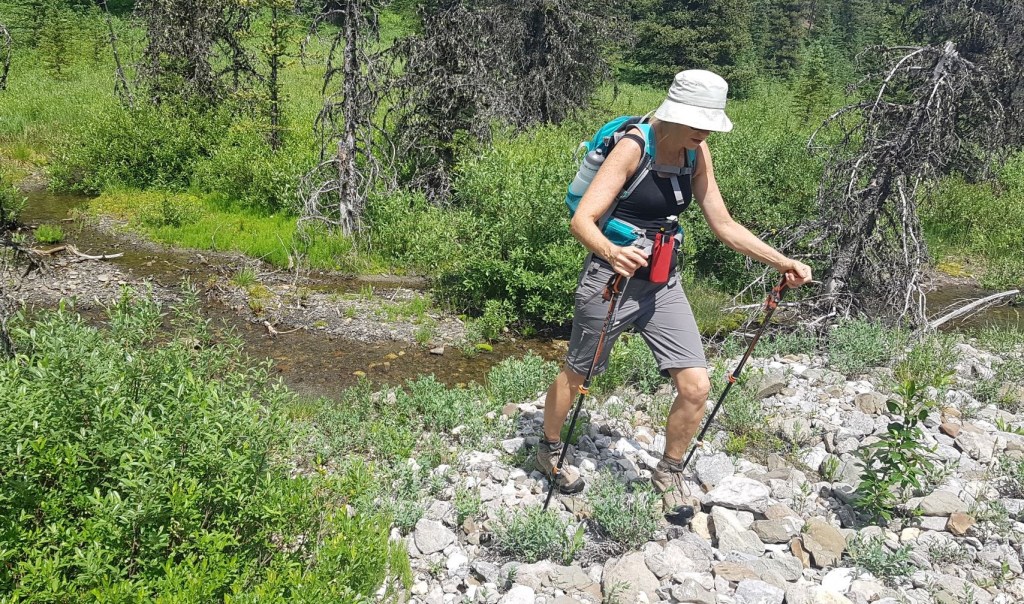
From the topo map, it looked like there was a road that lead straight to the start of the hiking trail. Unfortunately, that was an old decommissioned logging road. After driving up and down Powderface Trail for a bit to make sure we hadn’t missed anything, we pulled over on the side of the road. This added about 1.7 km to my estimated total distance, but like troopers, my friends were not worried and off we went.
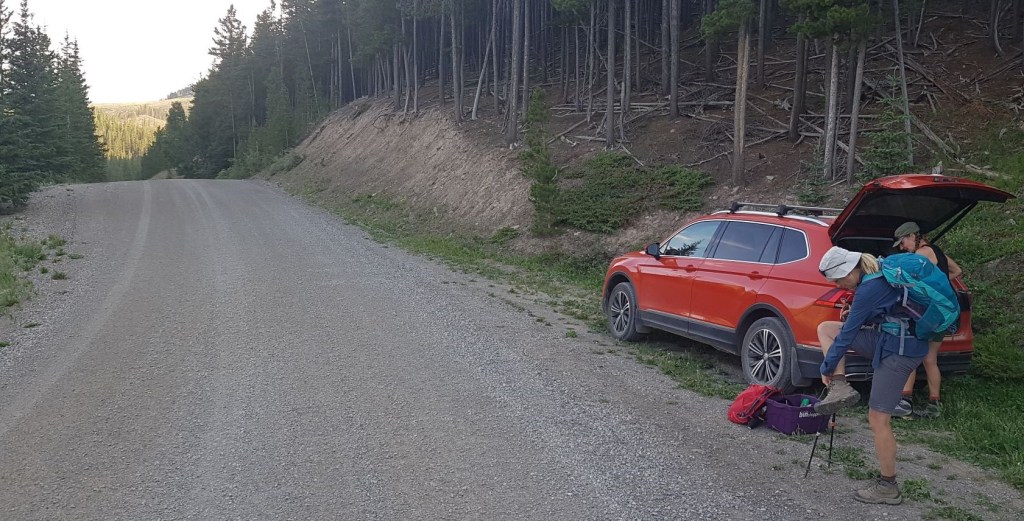
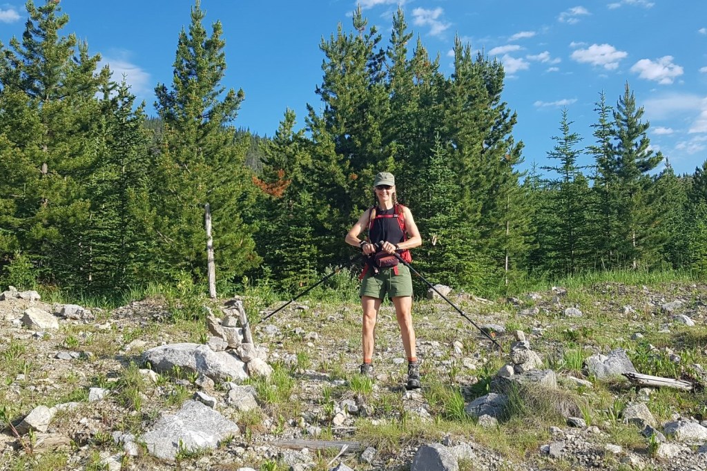
From the road, we found the flagging that marked the trail head, and walked down the embankment. We started hiking at 7:45 am.
We followed the wide swath of the old logging road.
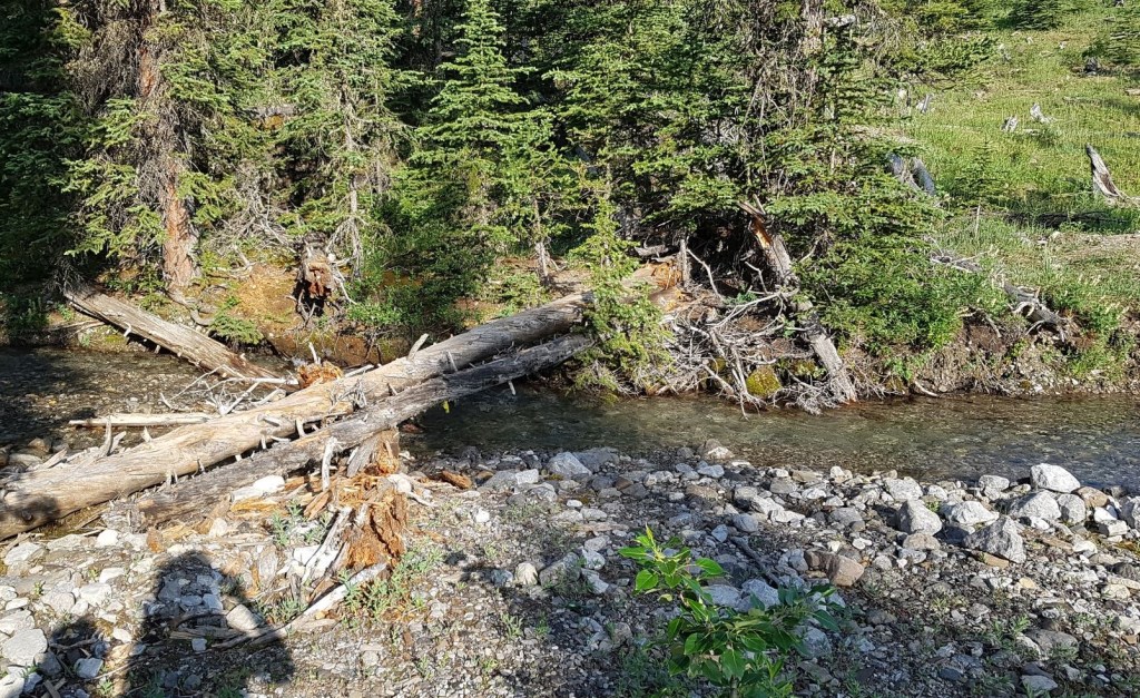
At the creek crossing, there were logs piled up, but we choose to go downstream a little bit and just hop across the rocks and logs in the stream.
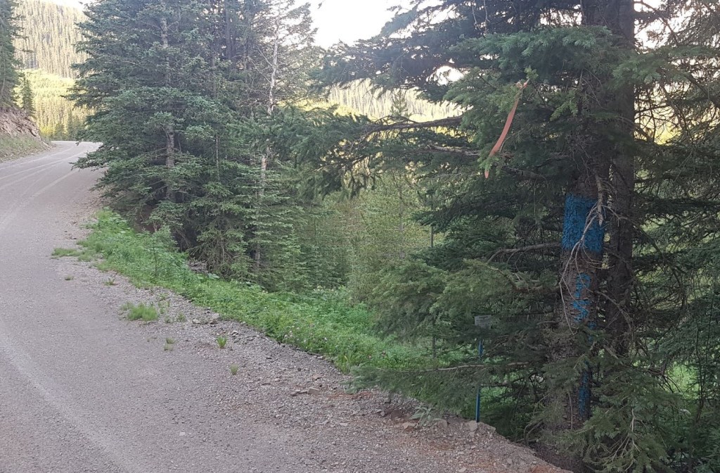
We continued to follow the logging road, until it started to veer left. This is about the 1.7 km mark. We then looked to our right, and found two cairns that guarded the entrance to the trail head.
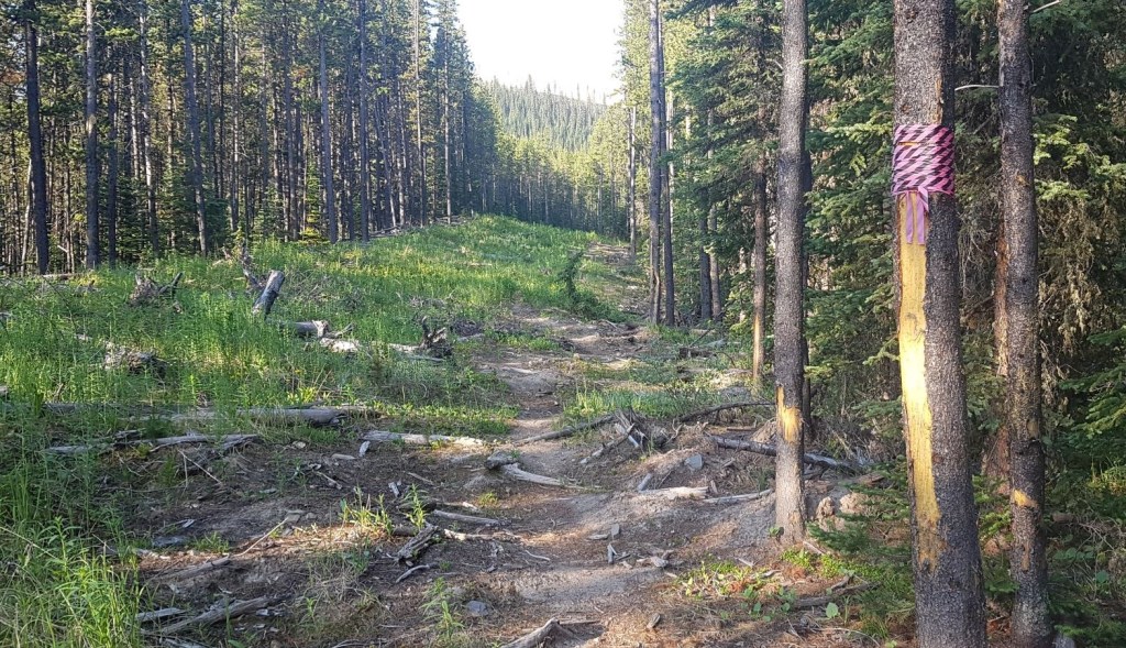
Main Trail
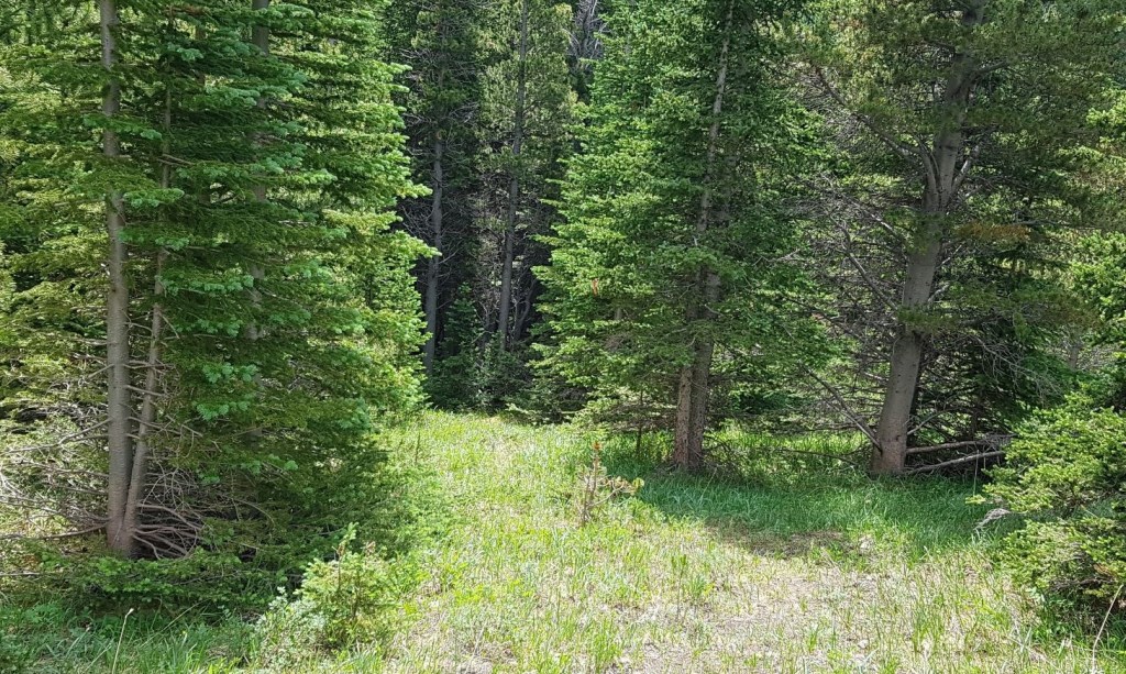
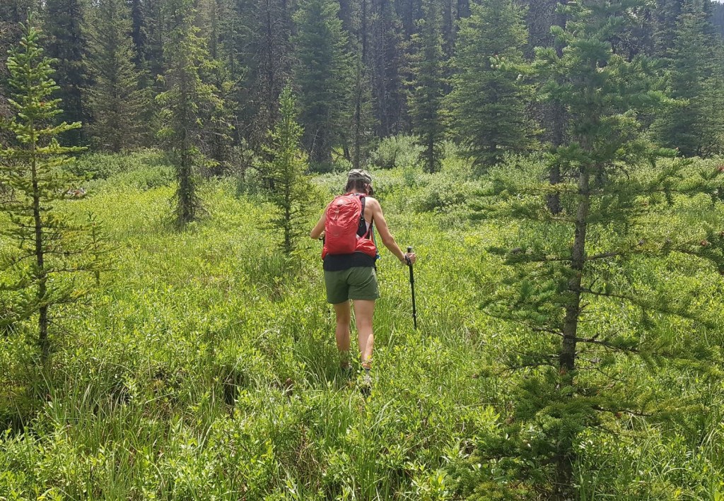
Once on the true hiking trail, we found a lovely path through a thick forest, which was fairy like in many places. Someone had been through with a chainsaw and hacked back the fallen trees for quite a ways. We were thankful for the clearing that was done.
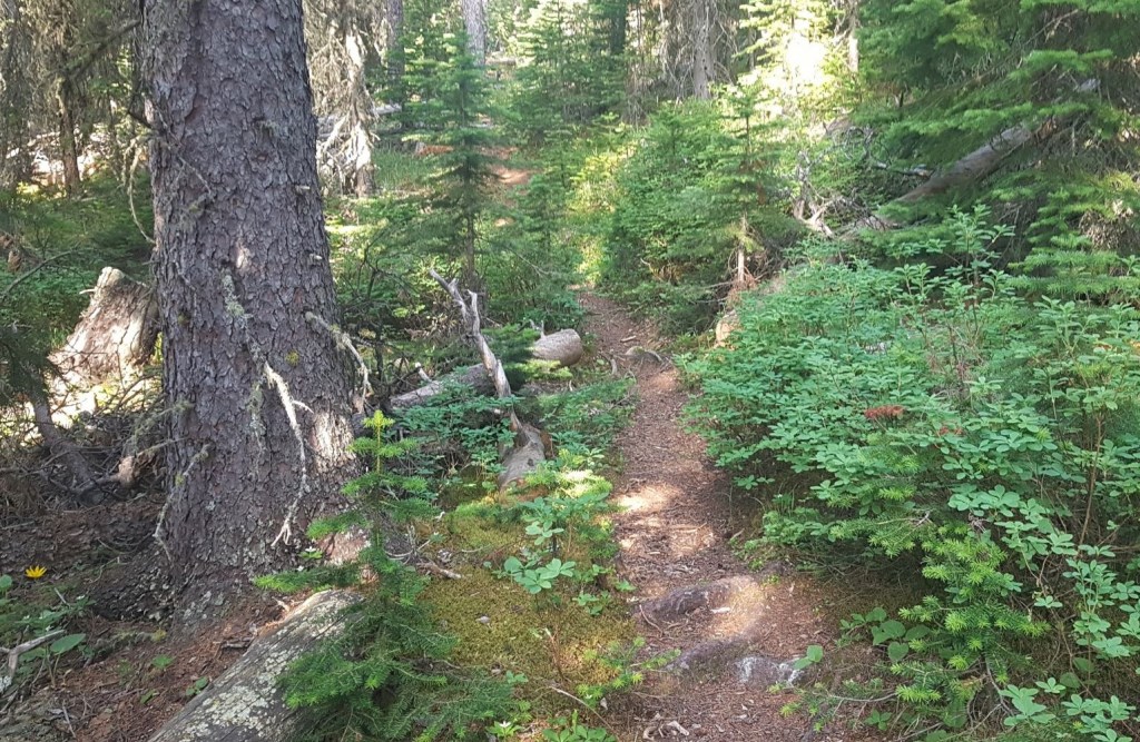
At about the 2.5 km mark, we came to the (now dry) creek bed. In the spring and fall, this area can be completely filled with snow. In July, it was nice and clear, which made navigating it a lot easier. We crossed back and forth about 100 times 🙂 but the trail stayed pretty consistent throughout and it was easy enough to follow.

Near the end of the creek but below the start of the gully, I hunted for the exit on the right. I had a false start, but backtracked into the creek bed again. A few hundred meters up, I found the rather large cairn on the right that marks the start of the Belmore Browne route. The cairn is around 4.3 km from the trailhead. If you miss it and go straight, that leads you to the Tiara Peak route, and the down track from Belmore Browne Peak.
Once above the creek bed, I angled around the bend to start gaining elevation on the ridge.

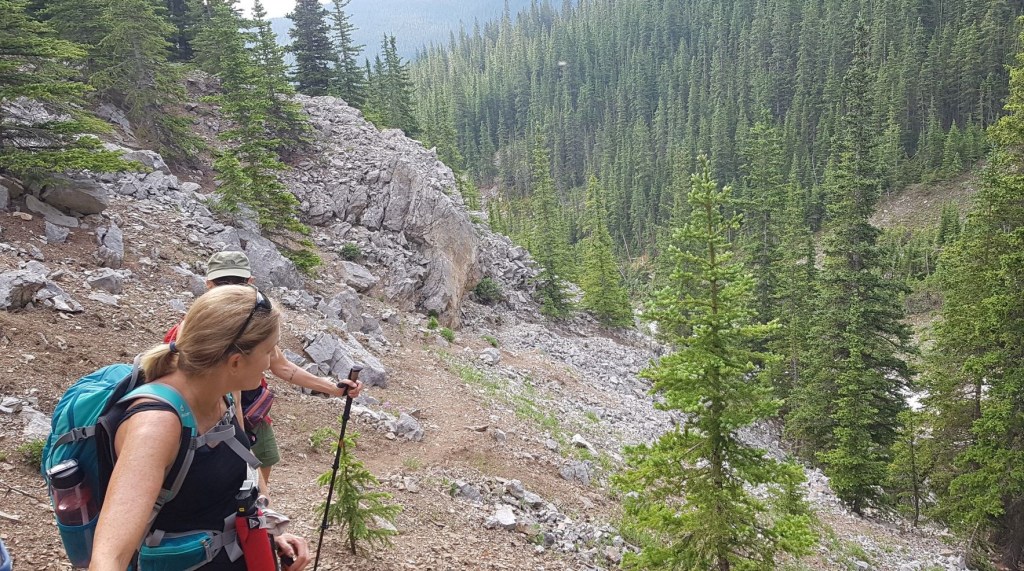
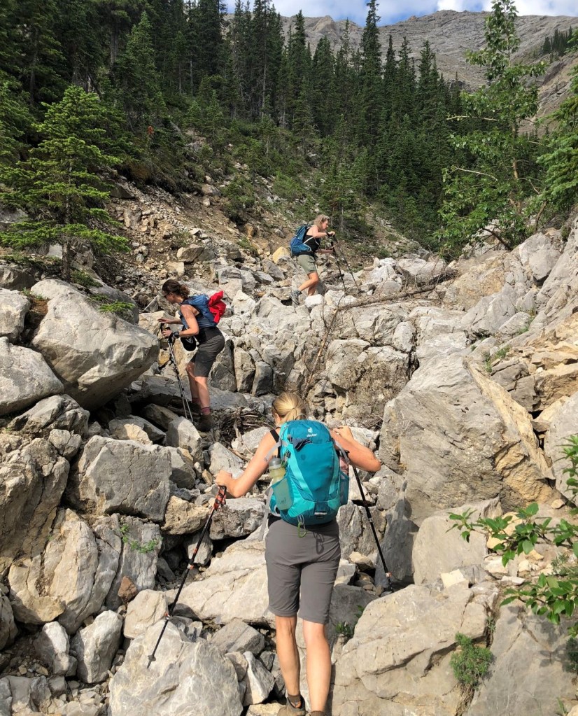
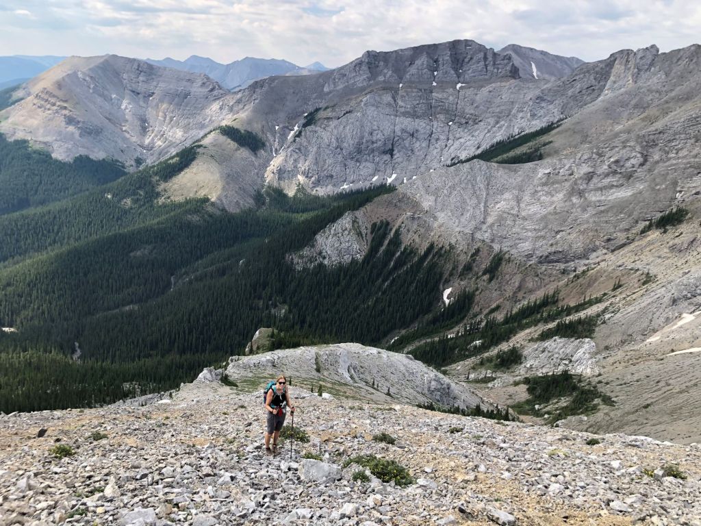
Once we were at the base of the Belmore Browne ridge, the sloggy portion of the climb was before us. However, with fresh legs, a great attitude, and still having the feeling of adventure, this portion slid past fairly quickly.
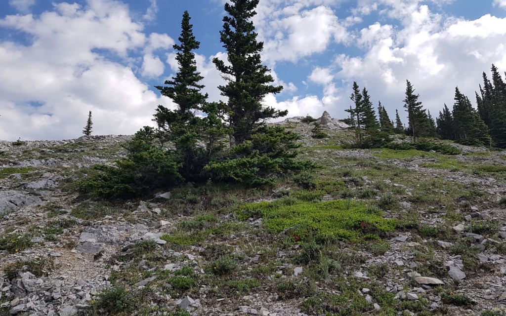

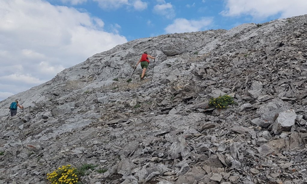
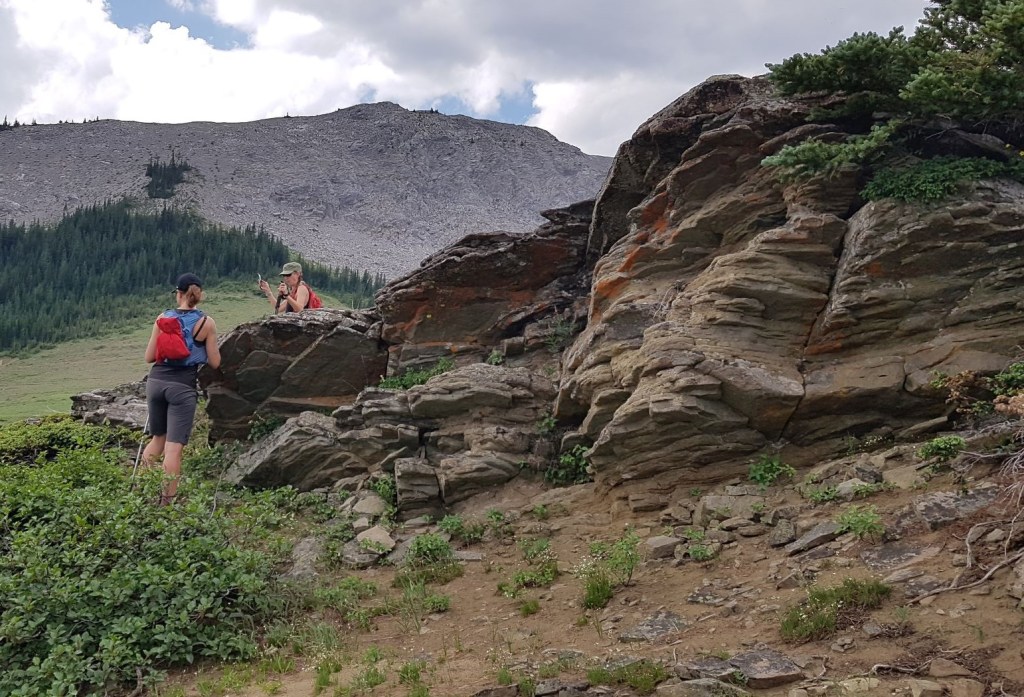
Once on the wide ridge, I bee-lined it for the fun white rock outcroppings. You can easily avoid these, but why? Honestly, these were the most exciting parts of the trail, and scrambling up the sides of these small features added fun to our day.
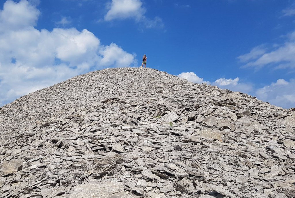
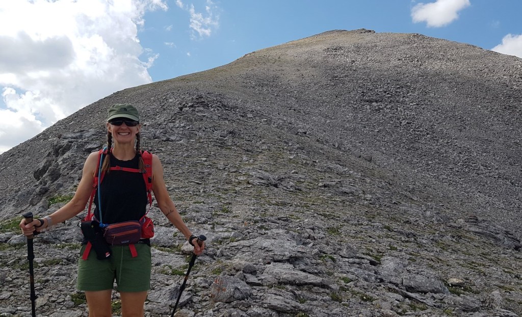
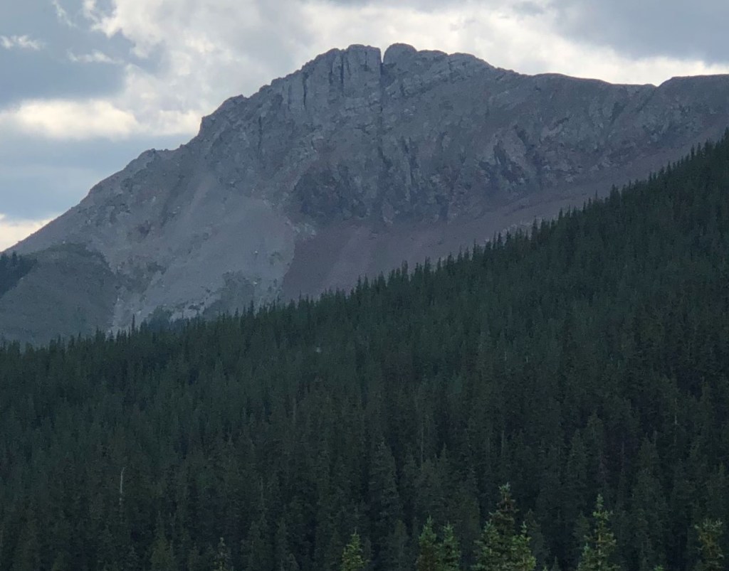
Above these rocky spines, it was now the prerequisite scree slope to the summit of Belmore Browne Peak.
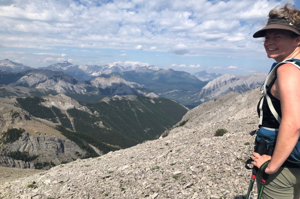
The summit is very misleading. That’s it right above Sonya. As you’ll see next, there is a giant fissure just to the right of the summit block.
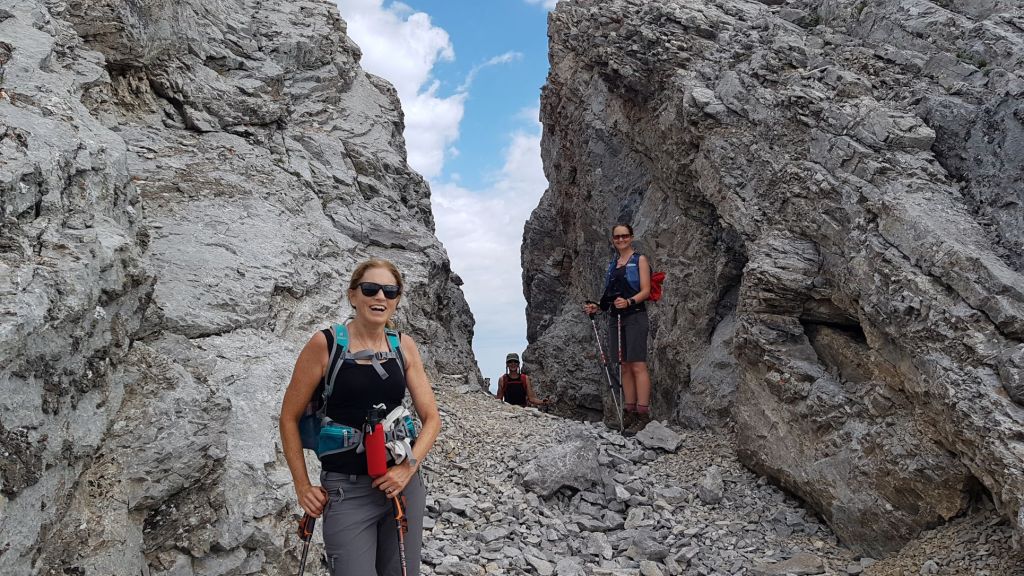

From the fissure, I was a little unsure if there was an actual ‘summit’ or if this was it. When facing the fissure, I went left, to get around the base of the rock. I then scrambled straight up the rock, because that was more fun (it’s possible to keep hiking around the base if you like).
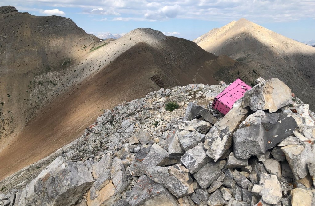
That’s when I spied the bright pink summit box! Woot! Woot! Erin and Nancy had never seen one of these before, and boy, were they in for a treat! 🙂

Belmore Browne Summit
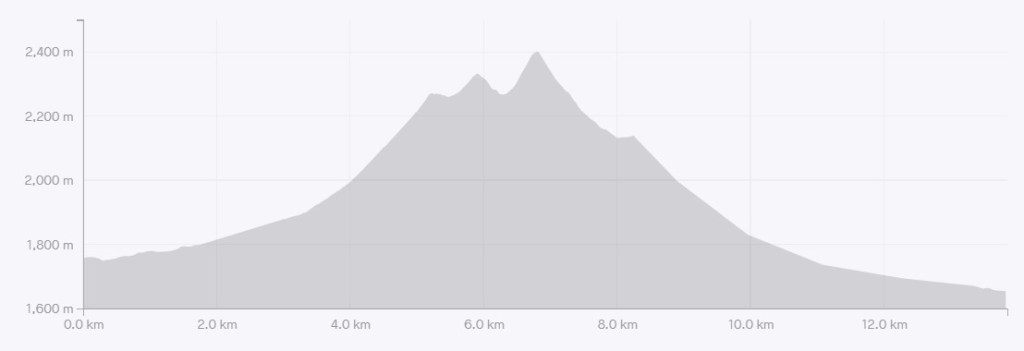
Distance to the summit of Belmore Browne is approximately 5.2 km. Elevation gain is about 602 m. Time to summit was 2 hours and 30 minutes, arriving at 10:12 am.
If you don’t want to do the traverse, there are two options for the return route. Descend the way you came. However, I’d recommend going a few hundred meters further to access the brown scree for a quick run down back to the gully.
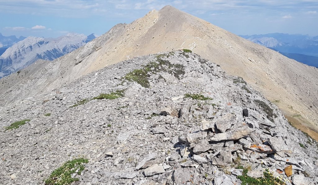
Belmore Browne Peak to Boundary Peak
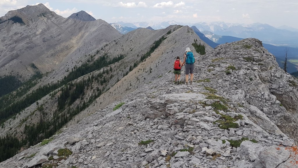
From the summit of Belmore Browne Peak, we had a great view of the rest of our traverse. From here, the navigation was simple – follow the ridgeline from one high point to the next.


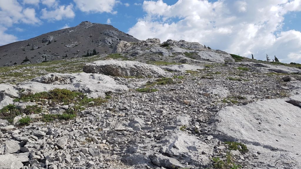
The hike to the unnamed Bump was quick and easy.

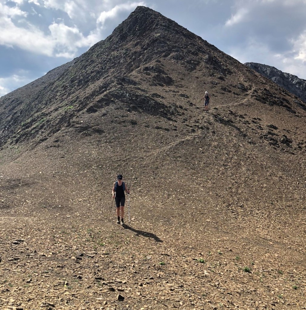
From the Bump, it’s a fairly steep descent down to the pass below Boundary Peak. Then it’s a long slog up a grey scree slope to the top of Boundary. The only good thing about this section is there is a pretty good trail through the scree, which makes the ascent bearable.

Boundary Peak Summit
Distance to the summit of Boundary Peak was about 6.8 km. Elevation difference from the trail head to the summit was 670 m, but total elevation gain to this point is much higher due to the loss and regain from the Bump, and from the Bump to Boundary Peak. Time to Boundary Peak was 3 hours and 30 minutes, arriving at 11:15 am.
Boundary Peak to Boundary Ridge
Most people summit Boundary Peak via Boundary Ridge, and then return the way they came. We were now heading towards Boundary Ridge, and using this route as the exit to our traverse.
From the summit of Boundary Peak, we headed east towards the long ridge below.

Distance to the exit point of Boundary Ridge is approximately 8.2 km. The elevation loss from Boundary Peak is 250 m. Time to this point is 4 hours and 15 minutes, arriving at noon.
Boundary Ridge to Lusk Pass Trail Head (end of traverse)
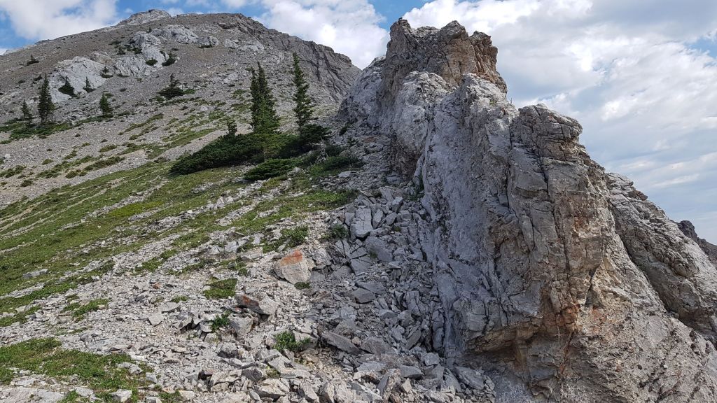
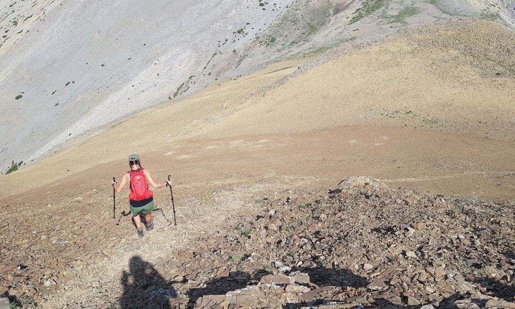
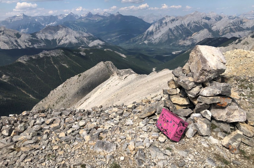
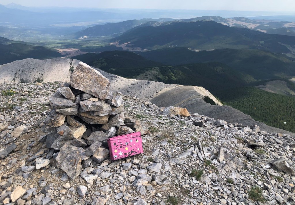
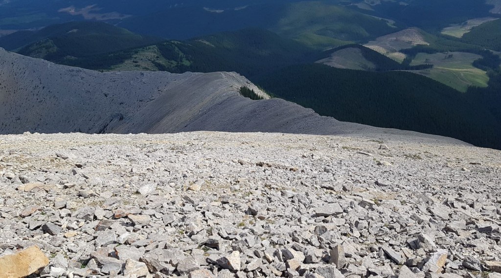
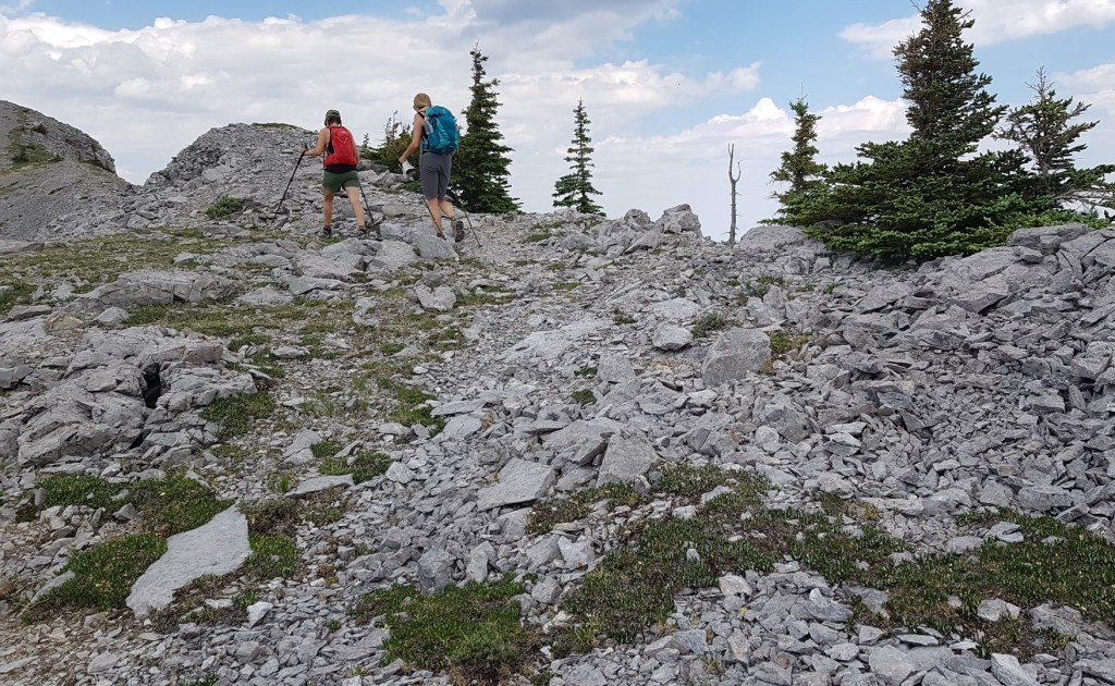
From the exit point on Boundary Ridge, we could see our route to the east along an open meadow. At the far end, after gaining a wee bit of elevation, we came to a large outcrop with a very impressive and artistic cairn.
From there, we turned right (south) and made our way downhill into the forest. Finding the forest trail was not obvious. We had to spread out and hunt around, because believe me, this was a LONG ways to bushwhack and I was not having that.
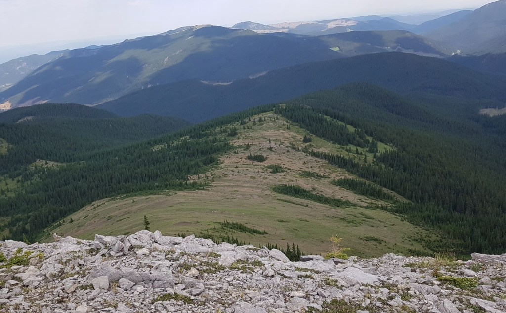
Looking across the valley is Cox Hill, which started this whole adventure six months earlier!

There was a short band of forest between the rock ridge and the meadow. We were meant to go right, but couldn’t immediately find the trail so just barged right through the middle, which worked just fine.

We hiked down the middle of the meadow. There was no trail in the low grass, but I kept an eye on the high point across from us and made straight for that.
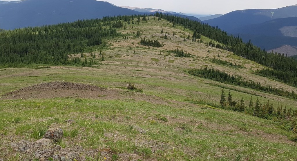
At the far end of the meadow was a rock outcrop, with a large and very artistic cairn on top. This was our cue to change directions, and head right, or south, to enter the forest. From here on out, it was one long boring forest slog back to the Lusk Pass trail head.

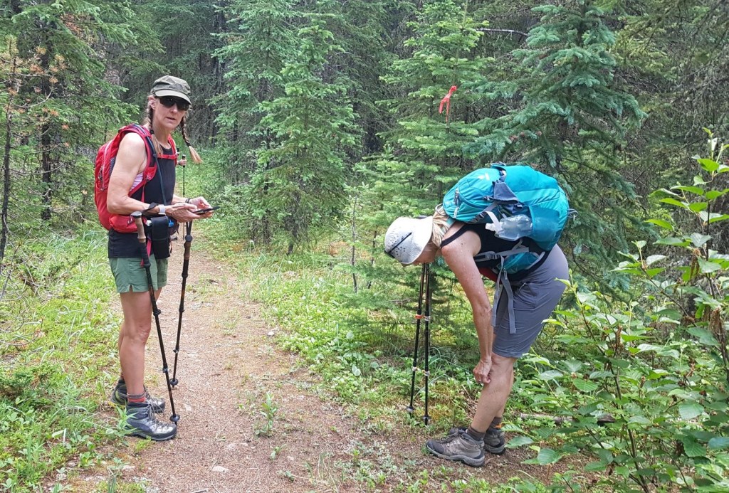
From the cairn, we headed south to pick up the forest trail. This was not as easy as it could have been. We spread out, and Nancy was the lucky winner in our game of “Spot the Tiny Bit of Flagging!”
At this point, things were getting a bit punchy and Sonya was deciding who to vote off the island. Nancy had just secured her spot by finding the flagging. I was the shoe-in leader and route finder (no mutiny yet). Erin and Sonya… only time would tell 🙂

At about the 11 km mark, we broke out of the trees and into a wide valley. While it was nice to get some fresh air, we were now in a boggy area. We tramped through the wetlands, hopping from one tuft of high ground to the next.
Once past this boggy area, we came to the creek crossing at about the 12 km mark.
From the creek crossing, we took a small detour and visited the horse camp. I have to say, this was set up quite nicely!

From the camp, we backtracked to the creek, and followed it for another km. We crossed and re-crossed this creek several times, getting our feet wet near the end. To be honest, we weren’t trying too hard to stay dry as the end was near. Plus, we were racing against a thunderstorm that was brewing above us.

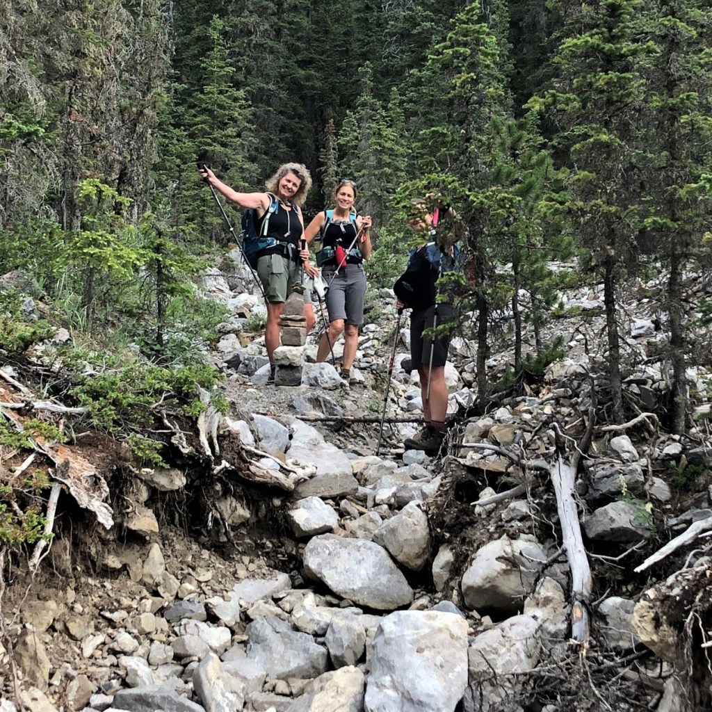
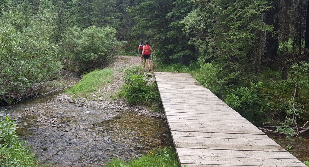
The last bit of navigation was turning right at the T intersection. Nancy (blue pack) is coming in from the Boundary Ridge trail, and Sonya (red pack) is standing on the Lusk Pass Trail that leads to the trail head.
If you are hiking in towards Boundary Ridge, look for the bit of flagging. The Lusk Pass Trail is way bigger than the Boundary Ridge trail, and I can see it being easily missed.
From the T intersection onto Lusk Pass trail, it was about one more kilometer to the trail head and our second car.

We successfully completed the Belmore Browne-Boundary traverse!!! We arrived here at 1:50 pm, just in time to get into our cars and avoid the massive rain storm. We drove past a gravel cyclist who was inching along, the driving rain no doubt very painful. As cyclists, we all wanted to stop and help him, but had no place to put his bike.
What a day! It was long, and it was hot, but it was also super fun to explore a completely new area. Sometimes you just have to get out your maps, and start making your own routes.
A big thank you goes to Sonya, Erin and Nancy for joining me. I had been planning this for months, but I needed the right crew to help make it a reality. Thanks also for the many photographs that you took and that I used liberally throughout the post.
If you found this post useful, please do me a huge favour and click the Star button to “Like” it. You can also follow my blog, follow me on Instagram, or join my FaceBook page Al’s Adventurers.
Alisen
Totals – Tracked on Gaia, displayed on Strava
Date: July 2, 2021
Group: Four (Alisen, Sonya, Erin and Nancy)
Distance: 13.8 km
Elevation: 765 m (2,525′)
Time: 6 hours 5 minutes (includes lunch & breaks)

The Belmore Browne peak is mislabeled on this map. It is instead the outlier directly to the east.
I love all things mountains! I live next door to the Canadian Rocky Mountains, however I travel the world to enjoy the many different mountain environments and cultures that I can. I hope you enjoy these trip reports, and that it inspires you to accomplish your own adventure goals.

Breaking trail through spider webs is never fun. The rest of the hike sounds great, though. I love the feeling of walking along a ridge line and scrambling my way to the top. The fissure looked like a lot of fun as well!
Hey Diana,
I’ve just about had it up to here with spider webs. They seem to be worse than normal, but I’m also usually the first one on a trail.
I’m enjoying your trek across the US. Enjoy your travels.
Alisen
I walked out my front door and into a spider web last week so I would agree with your assessment of them being worse than normal this year
Where are you that you have webs outside your door???
I really do appreciate spiders and how they clean up all the bugs. I never kill spiders in my home because if they are there, it means they are finding something to eat. But after having webs laced across my face a dozen times – eeewww!!!! Too much! 😂
I’m in the Denver area (not on the outskirts, fairly central) where there should not be so many spiders
Ah. Yes, I agree. That’s a lot of spiders for that area. Must be a bloom. Hopefully they are taking care of any mosquitoes you may have.
Wow, what a great hike!
Thanks! It was a lot of fun 🙂
🙂
Looks like great adventurous hike. You are great hikers. Might be a bit for me. LOL
It’s not for everyone, that’s for sure. However, I encourage everyone to do their own adventures, whatever that might be. This is my passion – what is yours? What can’t you live without?
Yes..I do love hiking around the world..
I have never seen (or heard) of these bright pink summit boxes before. What a great idea to mark the official summit. And how fun to open it up and discover what’s inside. The video gave me a good laugh. This looks like a beautiful hike. Not sure how I feel about those creek crossings though! Thanks for sharing. Linda
The pink boxes are just one guy who is on a bit of a mission. I believe it’s Ephraim Roberts??? It’s a great legacy for him. I think he only does summits in Kananaskis Country. There’s another guy named Cris T who puts black tube registers on summits in the national parks. It’s very much appreciated.
Oh wow! That’s quite the story and mission! I’m sure it’s much appreciated by fellow hikers who are not as familiar with the area. It’s always nice to have some sort of marker to denote the official summit.
Absolutely! I actually would not have found this actual summit without the pink box.
Thanks for another great adventure! Beautiful Alisen❣️❣️
Thank you so much Cindy! Thanks for stopping by ❤💕❤
Yet another adventurous hike Alisen.
You know it! Adventure is what it’s all about. Sometimes the adventure is just trying to find the darn trail head! 😂 Thanks for stopping by.
I guess it was an excellent adventure. Thank you for sharing ☺️😊🌷💞