January 21, 2022
Cascade Valley or the Cascade Fire Road is an ideal beginner ski. It’s very close to Banff, it’s a nice wide trail, and while it does have a bit of elevation gain, the hills are very gentle. It’s about 12 km return from the Cascade River bridge, a respectable day out for a new skier.

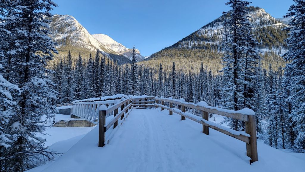
I used to ski the Cascade Fire Road when my kids were little and couldn’t go very far, but haven’t been back here in ages. In fact, the last time I was here, the bridge over Cascade River was still out.
Sonya and I only planned to ski to the Warden’s Cabin, but missed the turn off and ended up at the Stoney Creek campground. All good, because we needed a good 30 km ski.
Considering the conditions, and the potential for even worse, I felt we had a great day. It had snowed the night before, but the trail groomer was out with an injury so it was user tracks only. This meant we were up for a very slow ski. The temperature was -5 Celsius at the parking lot, and luckily for us, the cloud cover meant that it didn’t edge closer to 0 Celsius. Our wax worked all day, without any clumping or sticking.
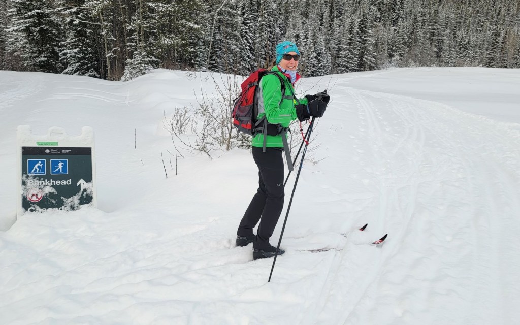
Gear
I had my trusty 20+ year old light touring waxable skis, while Sonya had classic cross-country skis with scales.
Overview
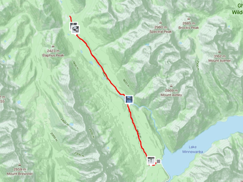
From the Lake Minnewanka Parking lot, we walked down to the start of the Minnewanka Loop trail. After a short downhill, we turned right at the Y junction to pick up Cascade Trail, which everyone calls the Cascade Fire Road. We crossed Cascade River just after 6 km in, and kept going to the Stoney Creek campground at about 16 km. On the way back, we took the side trail to visit the Warden’s Cabin. We then took the other side trail to visit the Cascade Bridge campground. From there, we skied directly back to the parking lot.
Parking and Trail Head
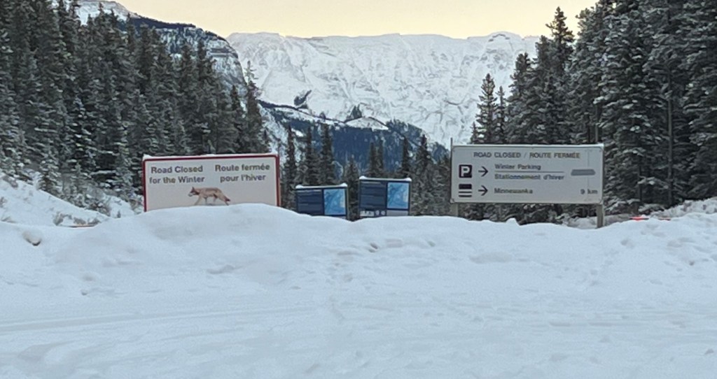
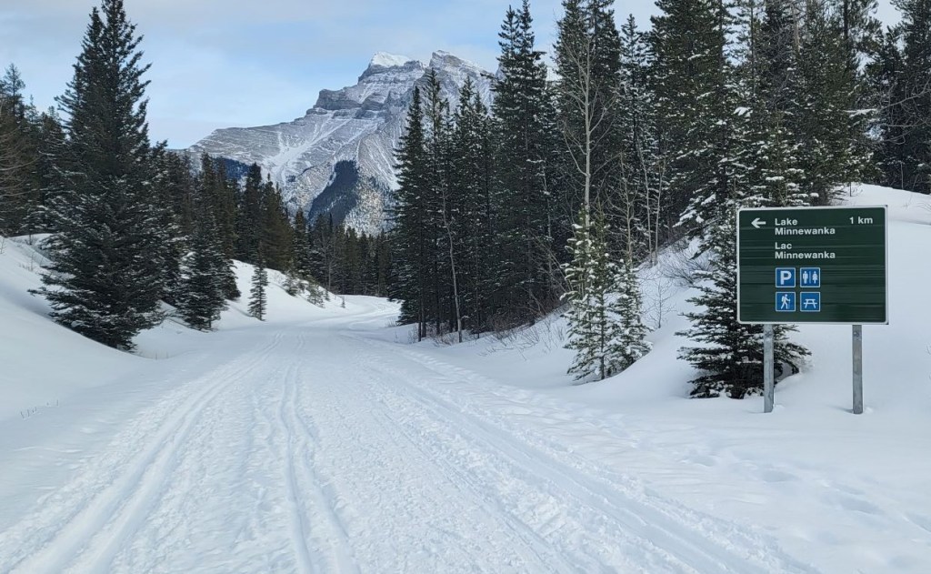
There is some confusion as to where to park, and Skierbob.ca has addressed this in the past. The easiest explanation is to keep driving until you cross the Lake Minnewanka dam and reach the Minnewanka Day Use area and parking lot. This is the lot with the large Parks Canada building. We parked on the east side of the building so we would be close to the outhouses.
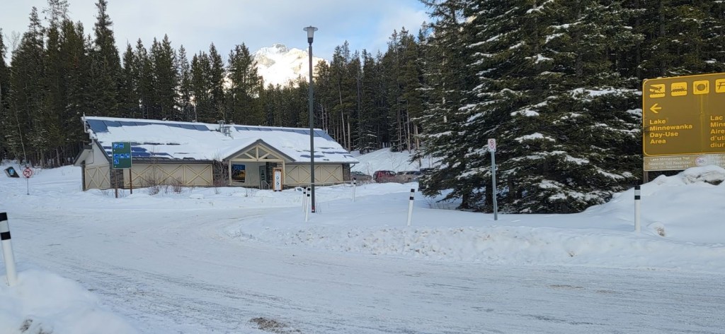
We walked west past the Parks building, and also past another trail on our right. We walked to the super wide trail with the gates and signage. This is the start of the ski trail. This is actually Minnewanka Loop Road, which you drive and bike in the summer.

Main Trail
Once at the gates, we put on our skis and glided downhill for about 700 m. At the Y junction, we went right to pick up the Cascade Trail, which everyone refers to as the Cascade Fire Road.


We immediately began to gain elevation after the Y junction, which we kept with some minor undulations, until we skied down to Cascade River.


The Cascade River bridge at just over 6.1 km from the start, which makes for about a 12 km return ski. This is the ideal spot for beginner skiers to turn around. It’s a fairly good distance, the trails are wide, and the hills are very manageable.
Immediately after the bridge is a side trail that connects with the Cascade River campground. We would visit that on the way back.
The trail from this point onwards is very different. I’m not sure if it is ever track set, but from the bit of machinery we saw, it probably is roller set. When we were here, it was 100% user tracks, with only one single track set. Someone more rambunctious than us would have to put in the second track.
After the bridge, we steadily gained elevation until around the 13 km mark. This entire section is in the trees, with not much in the way of views. Be sure to have a good friend along who can keep up a quality conversation for long stretches 🙂

During this entire time, we had yet to see a single other soul. We knew there were two women in front of us, because we saw them walking down to the trailhead when we drove in. We felt bad that they had to clear the track the entire way, but no matter how fast we went, we could not catch them. Sonya and I were so bored, we started making up backstories for them. One was dubbed “Responsible” while the other was nicknamed “The Squirrel”. We placed bets on being able to figure out who was who when we finally met them.
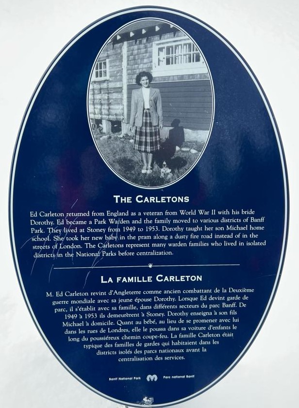
At the 14 km mark, we stopped to look at the side trail leading down to the Warden’s Cabin on the left, but failed to consult our map. As the cleared track went straight ahead, we elected to keep going.

Just before we reached the campground, we met the two trailbreakers. NOW we really felt bad because these ladies had a good 20 years on Sonya and I. We thanked them profusely for breaking trail, and chatted for a little bit. They told us to keep going to the end of their tracks so we could see the campground. Campground??? Where the heck was the Warden’s Cabin!!!???
Who was who? The Responsible lady was in front, and she had a delightful Scottish accent. The second lady wore two knee braces, and told us to look for her sitzmark where she fell in the snow. Sonya and I both agreed that she was The Squirrel 🙂

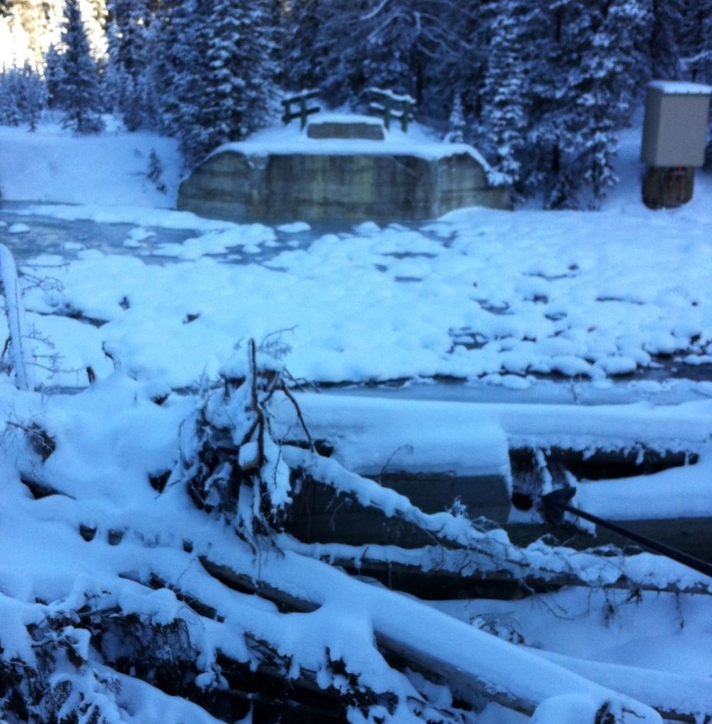
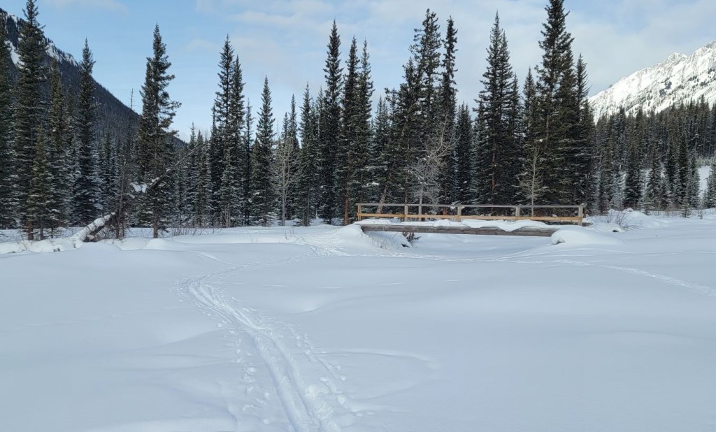
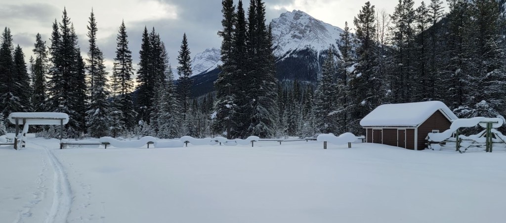
We reluctantly said good-bye, knowing we wouldn’t see anyone else for hours, and headed towards the Stoney Creek Campground. It looks like the 2013 floods made a huge mess of this area, as giant concrete pilings or bridge parts were strewn everywhere under the snow. We skied up to the left of the bridge, and then down into the campground. Everything was deeply covered in snow, but it looked amazing.


Distance to Stoney Creek campground was about 15 km. Time to arrive was 3 hours. These were some of the best views we would have all day, With the sun shinning, we made the most of it.
After a quick bite to eat, we started skiing back. It was time to find that Warden’s Cabin!
Cascade Fire Road Return
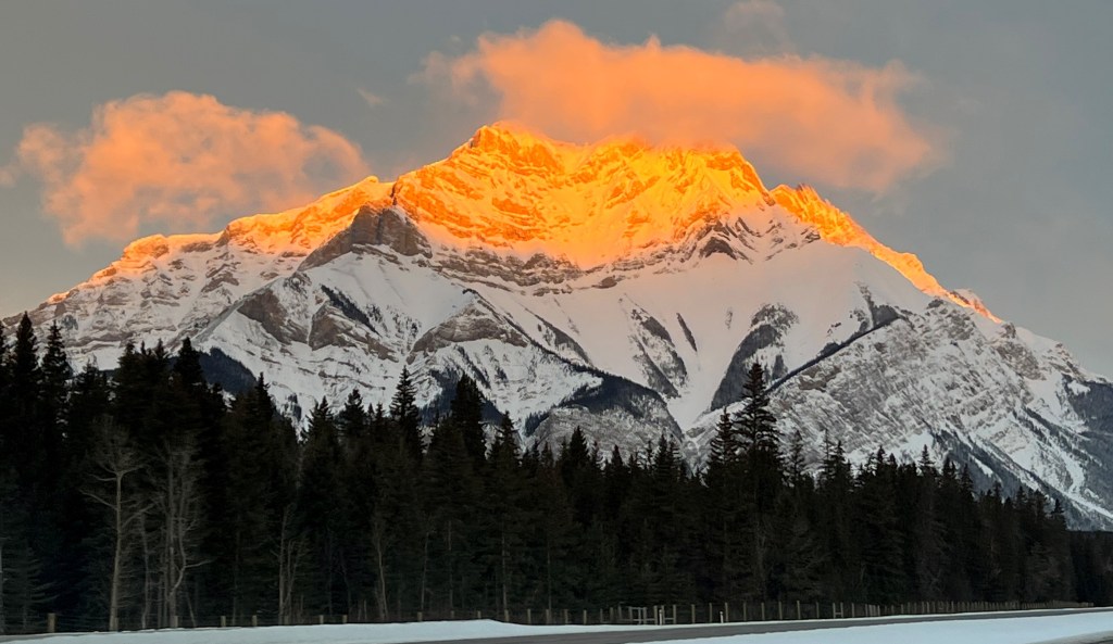
It wasn’t until we turned around that I saw we had skied well past the end of Cascade Mountain, and past Elaphus Peak. I’d never been back here, and it was fun to check out a new area.
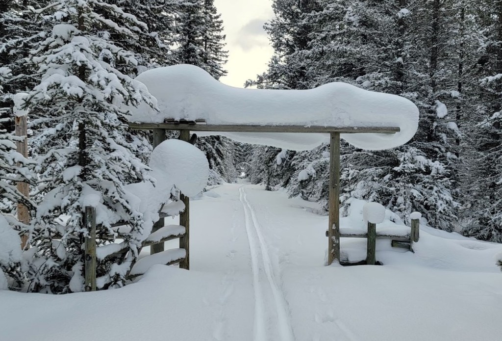
From the campground, we skied about 700 m to the side trail that would take us to the Warden’s Cabin. No one had been here today, so we got a little bit of trail breaking done. This section was gorgeous! A tight trail with snow hanging “Whoville” trees, and gates laden with snow. Magical.

The Warden’s Cabin is 1.6 km from the campground, or another 900 m from the start of the side trail.


After visiting both of the cabins, we started off again. We immediately started climbing up the short but steep hill to join the main trail. Once at the main trail, we turned right and steadily gained elevation to the high point at the 17.7 km mark.
While the trail after the high point was a long and gradual downhill, the warm temps meant we had to pole and ski the entire way. Thankfully the clouds had come in to obscure the sun, otherwise we might have had clumping snow or slush. No free ride home today!
As we neared the Cascade River campground, we finally saw one or two other guys. Sonya is an extreme extrovert and demanded that we stop and chat. I had to pepper them with ski questions just so she could soak up some of their energy. Thankfully one guy had light touring skis so we could get into the finer details of 3/4 verses full length metal edges 🙂
The north entrance to the Cascade River campground was just past the 23 km mark. We went right and skied into the campground. One snowshoer (who we passed later) had already been in and out that day, and he was so incredibly good about avoiding the ski tracks.


We then continued on to the Cascade River bridge, where we again gained elevation to the high point. We now hit the major crowds for the day. As this is a popular ski destination, we met everyone from hard-core spandex skiers to people bundled up tight and shuffling along. This track is wide enough that all skier abilities are welcomed and encouraged.
After such a slow ski, I was getting a bit tired. I was really hoping for a free ride down. Nope. The conditions refused to improve, and I had to pole my way down all the hills.
At the Y junction, we went left and hauled our butts up the final hill to the trail head.
Despite skiing a bit further than anticipated, this was a win because we beat last year’s longest ski by a few KMs. That was our Skogan Pass tour where we hit EVERY single trail we could, plus one extra by mistake 🙂
If you found this post useful, please do me a huge favour and click the Star button to “Like” it. You can also follow my blog, join my FaceBook page Al’s Adventurers, or follow me on Instagram.
Alisen
Totals – Tracked on Gaia and displayed on Strava
Date: January 21, 2022
Group: Two (Alisen and Sonya)
Distance: 30.15 km
Elevation: 464 m (1,532′)
Time: 5 hours 40 minutes (includes lunch & very slow snow)

I love all things mountains! I live next door to the Canadian Rocky Mountains, however I travel the world to enjoy the many different mountain environments and cultures that I can. I hope you enjoy these trip reports, and that it inspires you to accomplish your own adventure goals.

I really enjoy to see all this snow over there Alisen.
The original Warden’s Cabin looks so nice and cozy!
One more nice post from you Alisen!
I agree – I actually wish they would open up some of these cabins to the public. We have so few places to stay in the mountains. A wood stove and the creek right there for water – perfect!
This looks so so beautiful! (And sounds very challenging.) I really want to come to the Canadian Rockies in the winter for some skiing and snowshoeing. It’s just so pretty!
Hey Diana,
Oh, you would have so much fun! I’m touring a tonne of Americans this year. Lots of California and strangely, lots from DC. I had two from Florida on Wednesday too. Please let me know if you come up. We can do a fun scramble together.
Alisen
Absolutely! It will probably be a couple years until we’re able to get up to Canada, but I can’t wait!
Do you know how often they groom trails in the National Park and in K country? Is there something like a weekly schedule?
I believe there is a set schedule in K Country. I’ve noticed over the years that they try and get the trails done in time for the weekend. So if I show up Friday morning, they are pretty fresh.
Banff is a mystery. When I wrote that “the” groomer was away sick, I indeed meant One Groomer! How one dude does all the trails, I’ll never know. I keep a close watch on SkierRoger and Cross-country YYC and hope for good trail reports on fresh grooming. Good luck and I hope you find fresh track setting!
Alisen
Thanks. We’ve been looking to see when the trails in k country are done and it often seems to be 2 days before whenever we are planning on going out! Our daughter is visiting from Vancouver this weekend so we are hoping to do some skiing with her. Hopefully the tracks will still be in good shape despite the warmer temps 🙂 Thanks for the ideas and updates. I appreciate your blog!
Oh! How nice! Enjoy visiting with your daughter. That’s so special.
With the warmer temps, I would think the higher the better, like Elk Pass or Blueberry Hill. Nakiska area might be done until more snow comes.
A true Winter wonderland. You are very lucky. Mel
Thanks Mel – it truly is fun to ski in so much fresh snow. Unfortunately, just a few weeks after I did this, our snow has dried up. It’s only mid-February and …. no snow. I’ve been out hiking instead, which really bites.
This looks like a beautiful spot to go cross-country skiing. Breaking a trail can be hard work, but it’s even worse when someone comes along and walks or snowshoes over your tracks. Thankfully that didn’t happen. I’m impressed that your 20+ year old skis still work like a charm. We’ve been doing some cross-country skiing this winter and it’s such a great workout and a good way to see a different side of the trails.
It’s amazing how cross-country skis just refuse to give out. Buy once, and use forever.
I’m glad you’re out skiing. I always thought that anywhere east and north of Alberta would be absolutely prime cross-country ski terrain. It’s a great workout, and makes you LOVE the winter.
Enjoy!
Alisen
My kinda snow!!! 😀
P.S. not necessarily the quality, because I wouldn’t know ‘slow snow’ from a poke in the kneecaps, but the quantity! 😀
The quantity was delightful, and really, I should never complain about new snow. Especially because we are now in an extended dry spell. These trails are now almost bare in places. Sigh…