May 15, 2022
I was surprised how much I enjoyed Porcupine Ridge. I wasn’t too interested in it, because I thought it was going to be like Wasootch Ridge – endless up and down with not much fun. I was wrong! Right off the bat, there is fun. We had three water crossings at the beginning, and then boom! Hands on rock just to start the hike. Loved it!
Once on the ridge, there were several opportunities to do a bit of easy scrambling. Not interested in that? No problem! Simply walk around to the right.
There are three major ‘stops’ along the way. A mini summit with a monument to a fallen friend. A false summit with fantastic views. Finally, the actual summit with the cairn. Want to go further? You definitely can, but it’s sketch to get over to the tower.
Gear
Hiking boots, poles and regular day pack kit. If going in the winter, add in gaiters and microspikes.
Overview
Start from your choice of trail heads (below). From Porcupine Creek, start hiking up the bottom edge of Porcupine Ridge. It is fairly steep in spots. Once on the rocky ridge, either hike up, avoiding the rock outcrops, or choose to do some easy scrambling on the ridges. At the false summit, return the same way back to the trail head, or backtrack down from the false summit, and go around to the east of the false summit block. From there, follow final ridge to summit. Return the same way.
Parking and Trail Head
We had a choice of parking spots. Option A: Park on the south side of Highway 40, just to the east of Porcupine Creek. Follow creek up to the bridge, then follow my trip report from there.
Option B: I chose to park at the Wasootch day use area for two reasons. 1. I prefer to have access to an outhouse. 2. I like a bit of an approach as a warm up/cool down.
From the Wasootch parking lot, head east into forest, and not south to follow Wasootch Creek. Immediately past the picnic table are two trails. The LEFT one goes to Porcupine Ridge. The RIGHT one goes up Wasootch Ridge. Go LEFT.

Follow the well defined trail for 1.9 KM, as it winds around the base of Wasootch Ridge, and connects with Porcupine Creek.
At the bridge, go right before crossing the bridge. On the hike in, we crossed the bridge, and continued up the left bank, only to have to cross the creek. On the way back, we discovered a trail on the right side of the creek that avoided this extra creek crossing.
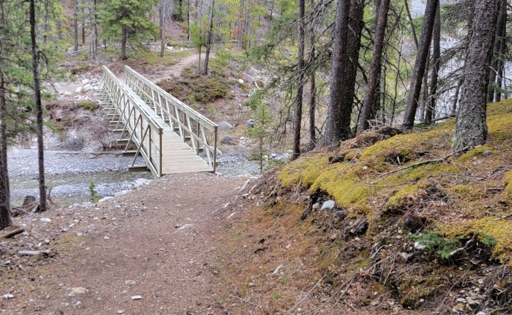
NOTE: There is a trail directly across from the bridge, but this is an alternate route up Midday Peak. Continue up the creek bed for Porcupine Ridge.
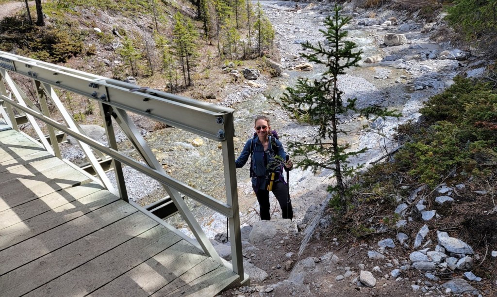
There were three creek crossings. Be aware during the spring melt that water levels will rise quite a bit during the day. The creek will be its lowest in the morning. By late afternoon, rocks that were dry and above water can now be submerged.


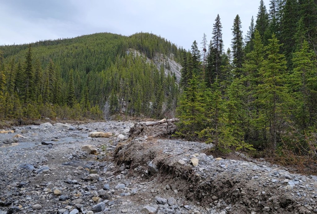
After the third creek crossing, I looked up and saw Porcupine Ridge rising out of the creek valley.
Immediately, we had fun. It’s ‘hands holding onto rocks’ steep here. While the trail backed off from its opening salvo, it continued to be a tonne of fun.

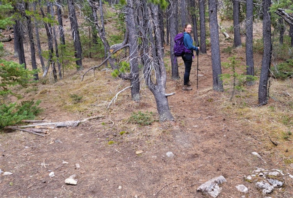
Main Trail
Once on the main trail, it is beaten in enough to be easy to follow. The elevation gain is fairly consistent, with a few steep bits thrown in just in case you weren’t breathing hard enough.
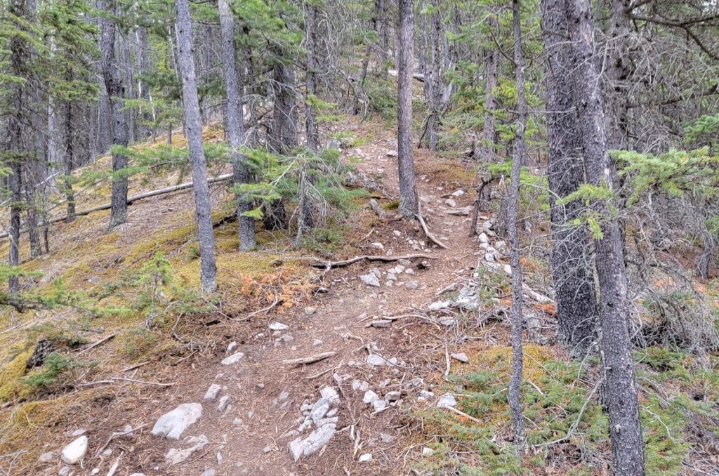

There were two navigation spots to point out. The first was on a ridge. It looks like we would hike straight ahead, but the trail takes a hard left into the woods. The second was shortly thereafter in the woods. There is a Y junction. Go right. The left is blocked.

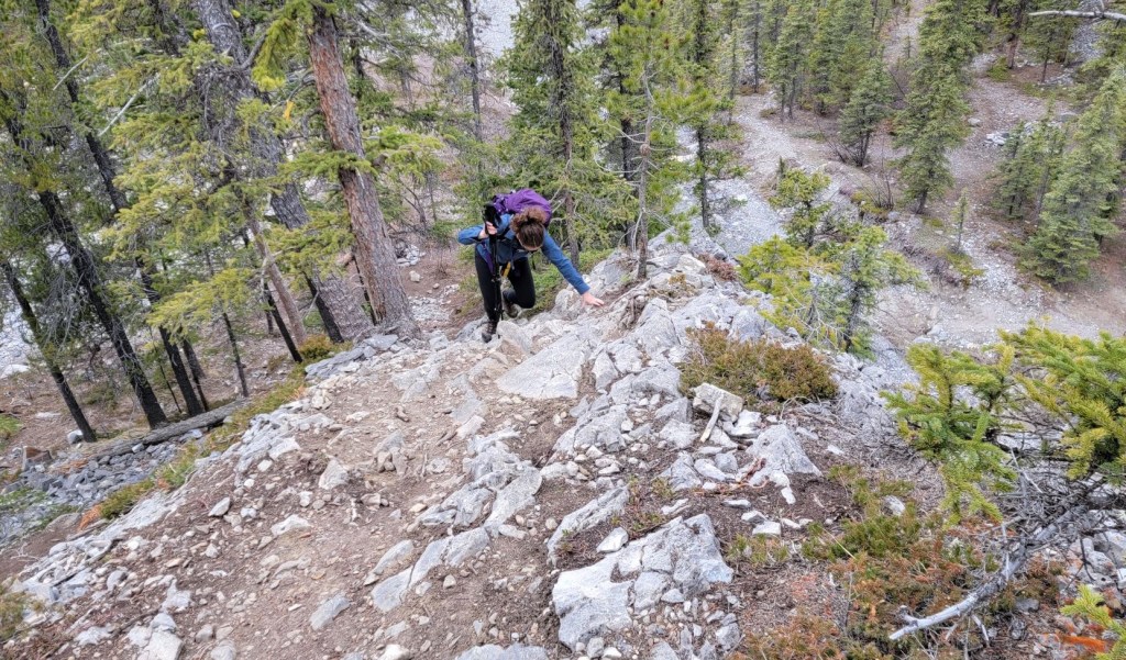
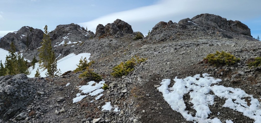
Once the rocky ridge comes into view, the fun really begins. Here we had the option of doing some easy scrambling up the rocks, or there is a by-pass on the right. The first section of scrambly bits ends in a memorial to Corey Beaver.
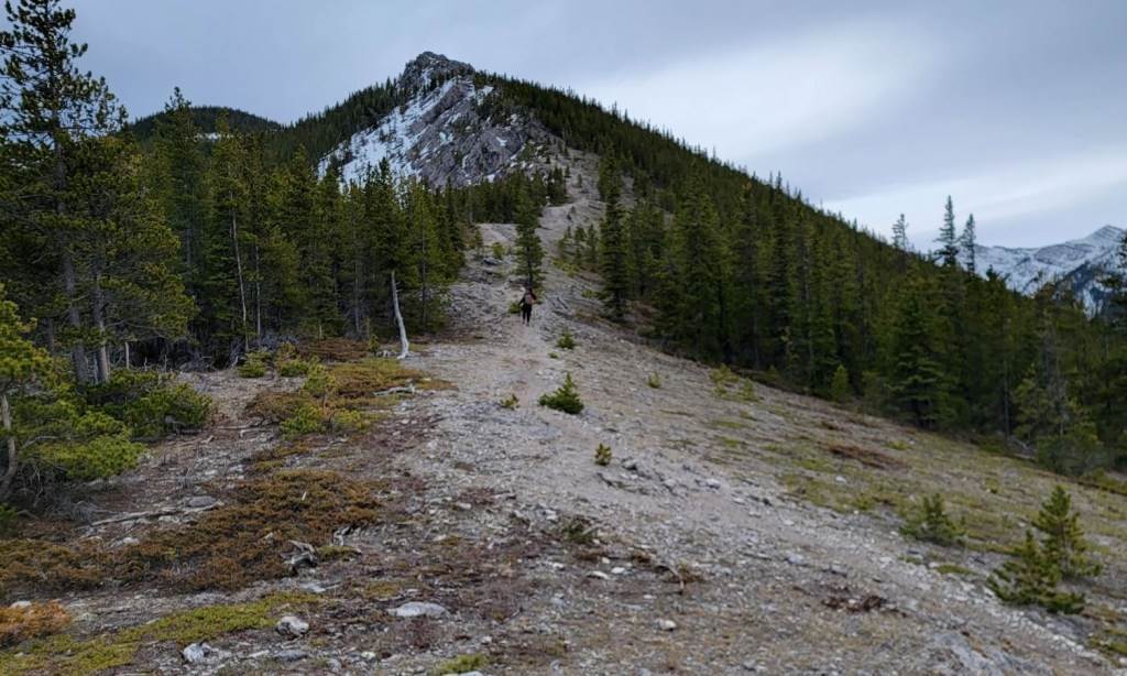


There are several areas to go up the rocks, always with a hiking option around the base.


False Summit
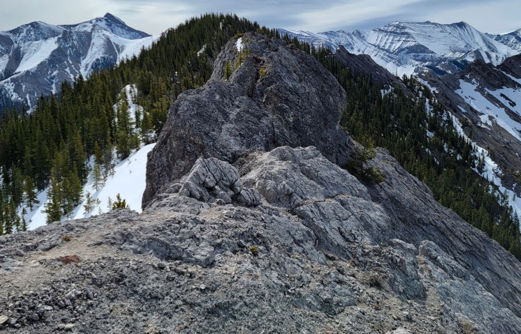
From here, the trail descends down and enters the trees again. Once we left the trees, we found a short ridge of pretty cool looking pinnacles. We hiked up among them to the false summit, and took in some spectacular views.

Porcupine Summit
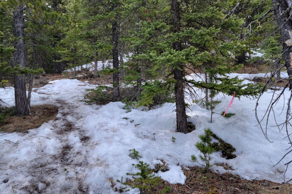
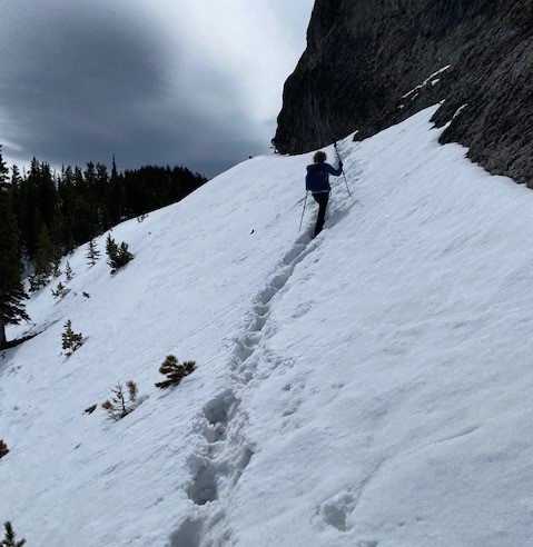
Once we got our fill of the views from the false summit, we retreated back to the base of the pinnacles. I traversed to the east side of the false summit block, and punched through two lingering snow slopes. On the way up, the snow was frozen, but it was already turning isothermal on my way back.
The trail entered a forest once again, but it was obvious that not as many people continue past the false summit. The trail was easy enough to follow, but definitely not the beaten in path from lower down.
We kept to the rocky ridge on the left, only because that was prettier, and we found the summit cairn on the top. We choose to continue past the summit cairn to get a look at the narrow ridge that connects to Porcupine Tower.


Distance to summit from Wasootch day use area is 6.5 km. Elevation gain was 770 m. Time to summit was 3 hours, 15 minutes (includes side trip to false summit).


Porcupine Ridge Return
The way back gave us some amazing views. Every way we turned, there were impressive mountains to view and admire. I am glad we got an early start. While we had the trail and summits to ourselves on the way up, by the time we turned around, the trail was getting quite busy. There was now a steady stream of people working their way up.


When we got back down to the Porcupine Creek crossings, the climbing community was in full swing. We stopped to watch a few people climb up the walls. After the bridge, I will admit that the almost 2 km back to the car was a bit of a drag, however it was a nice cool down for my muscles and knees. I wasn’t sore the next days, despite this being an early season hike.
Thanks for reading! Please do me a huge favour and click the Star button to “Like” it. You can also follow my blog, join my FaceBook page Al’s Adventurers, or follow me on Instagram
Alisen
Totals – Tracked on Gaia, Displayed on Strava
Date: May 15, 2022
Group: Two (Alisen and Erin)
Distance: 11.5 km
Elevation: 770 m (2,541′)
Time: 6 hours even (includes lunch and breaks)


I love all things mountains! I live next door to the Canadian Rocky Mountains, however I travel the world to enjoy the many different mountain environments and cultures that I can. I hope you enjoy these trip reports, and that it inspires you to accomplish your own adventure goals.

I love the way you write up your experiences and tell the story of your latest adventures. You make it so appealing, like I want to join in the fun! Always love reading your posts. 💕
Thank you! You are on such an amazing adventure yourself with the big move. I’ve not been brave enough to do that.
Hehehe, I guess we both have our areas of adventure… Great admiration to you.💐
Great pics and information. Thanks for sharing.
In case you ever come to Canada 🙂
I loved this one … despite slipping and falling on the logs which meant I started off with wet feet. But I did it on a hot day last summer so my feet were dry by the time we reached the summit 🙂 Great photos!
You know what? You are NOT the only one. My hiking buddy that day Erin ALSO slipped on those EXACT SAME LOGS!!! I guess I should have put that into my trip report. Thank you so much for pointing that it. It’s a real danger, especially when the creek is high.
Wow, stunning views is right!
It really was incredible. It was nice to be surprised by such a fun hike when I thought it was just going to be a boring grind.
Nice. You could write the brochures.
True, but the market on guide books is already cornered 🙂
Beautiful place for adventure! Wonderful photos ! Thanks for sharing your excellent experience.👍🌹🙂
Thank you Priti. It’s truly a beautiful hike.
You are welcome stay blessed 🤗🥰