Junction Hill is an ideal shoulder season objective. With a lower elevation, Junction dries out fairly early in the year. However, wind is definitely a factor. I was blown off twice last fall (well, to be accurate, I refused to even leave the car on the second attempt as the wind pushed the car from side to side), so keep an eye on the weather.
Junction Hill is a natural loop. According to Spirko, the ideal rotation is clockwise (hike up west ridge, and come down on the east ridge), however the two groups of hikers we saw were all traveling counter-clockwise. The west side requires some fiddly route finding, and I prefer to do that in the morning when I’m fresh. The descent down the east ridge is straight-forward but absolutely beautiful.
The east facing slopes of the west ridge tend to hold snow that cannot be seen from the road. On an earlier wind-swept attempt, we found deep snow and had to turn back. Even in mid-May, we found one deep section of snow.
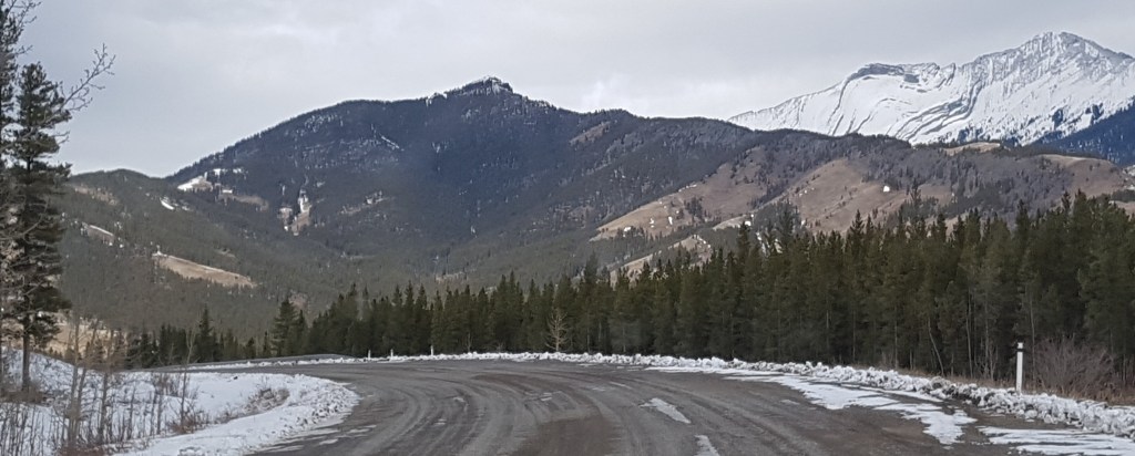
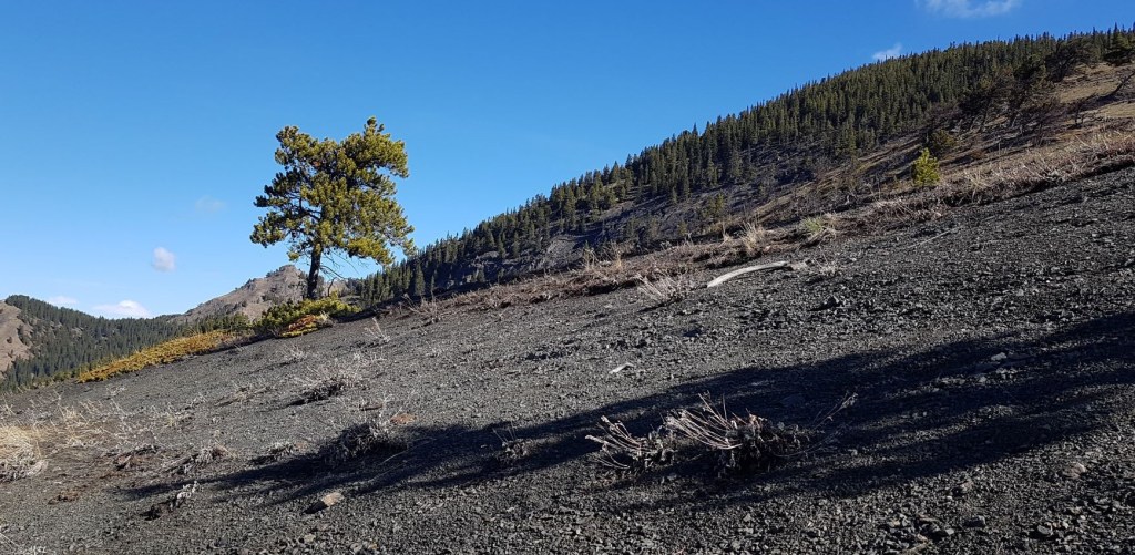
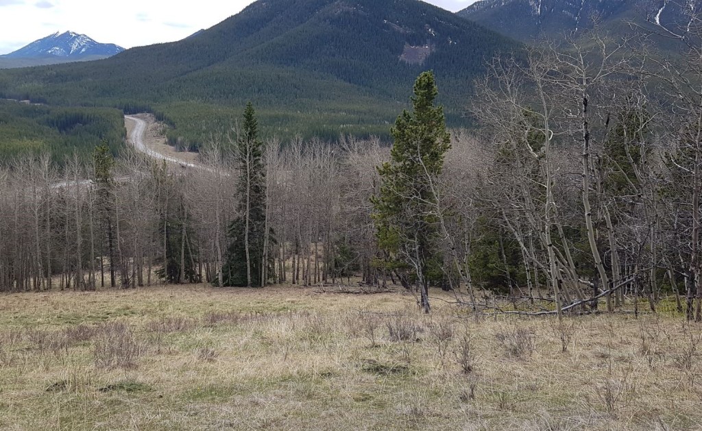
Junction Hill as seen from Highway 941. This gives a nice view of the wide left (west) ascent ridge, and the narrower right (east) descent route.
Gear
Hiking boots, poles and regular daypack kit. If attempting in shoulder season (when the trail is dry), then gators and spikes are a good idea.
Overview
Park at the Winter Gates on highway 541/highway 40 south. Head towards the west ridge. Find the old road, and follow that to the end. Gain the ridge, follow a forest path down then up. Follow a forest path to hit the large talus slope. At the top of the talus, gain the open ridge on the left, and follow it to the final summit point. Return the way you came, or better, follow the narrow east ridge down. At the Spirko Spot, descend off the ridge, and walk down through grasslands back to the highway.
Parking and Trail Head
When the winter gates are closed, park on either side of the road. When the gates are open, make an effort to pull off the road. Or, you can park at the Highwood House on the corner and walk over to the trailhead.
The winter gates on Highway 40 south. The trail starts just past the sign.
Take the prominent trail starting right at the winter gates, heading west. This trail will quickly peter out. Keep your eye on the main west ridge heading to the summit. You can aim for that and head straight up, but the nicer way is to find a narrow ridge prior to the main ridge. This leads to the old exploration road.
There is just the faintest hint of a trail through the grass. Head towards the low ridge beside the main skyline ridge. There you will pick up a stronger trail that leads to the old exploration road.The little ridge ahead leads to the exploration road.On the little ridge, looking back towards the highway. There is a trail here, and leads straight to the exploration road. Behind Sonya is Coyote Hills.
Main Trail
The trail is large and obvious on the exploration road.
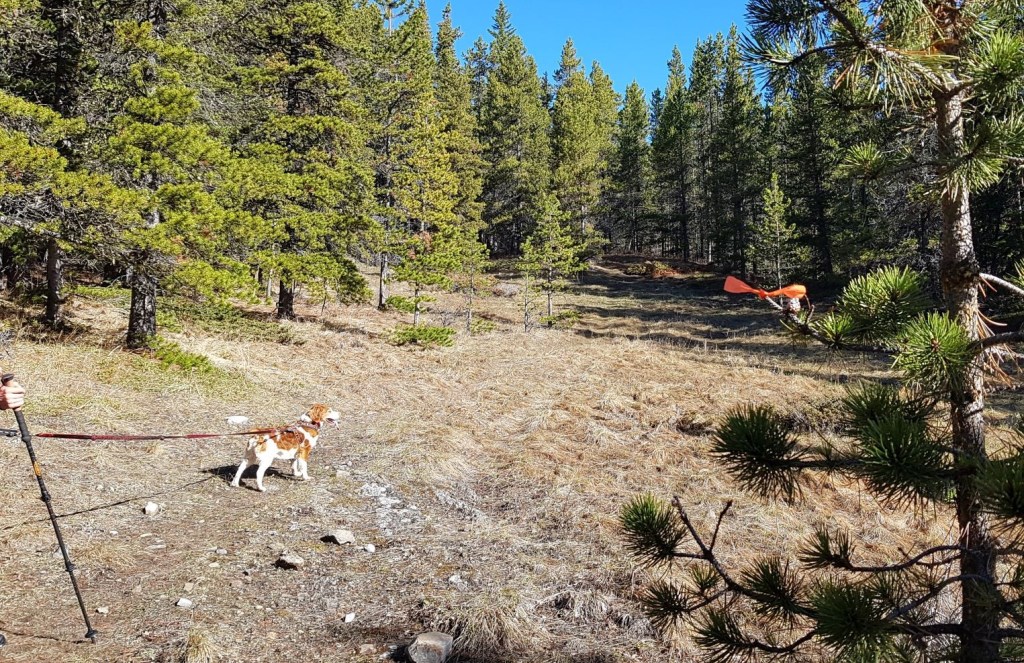
The old road curves around to the left, and soon enters the trees. Photo credit: Sonya LaingWhen the trail starts to fade again, some kind soul has put in flagging. I cannot guarantee this will always be the case. In any event, the trail does follow the wide break in the trees and the flagging does prevent trail braiding. At approximately 2 km from the trail head, the trail then pops out of the trees, and provides a lovely view. From here, turn right and enter the trees again, heading up hill.I am 90% sure the trail is further to the left, but when I saw this absolutely magnificent rock outcrop, well, I just had to go visit it. Once on top, we went left to pick up the trail again. Photo credit: Sonya Laing.
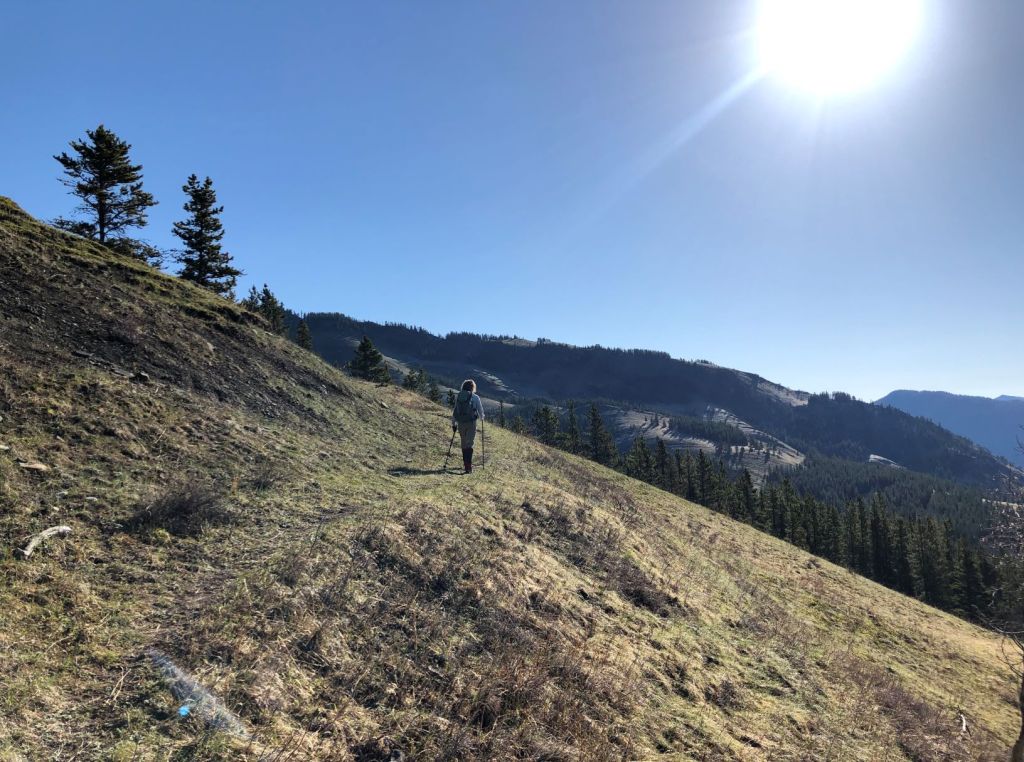
When you get to the top of this small ridge (shown above), the trail heads down hill to a small saddle. It will then head back uphill, and will continue up until the summit.
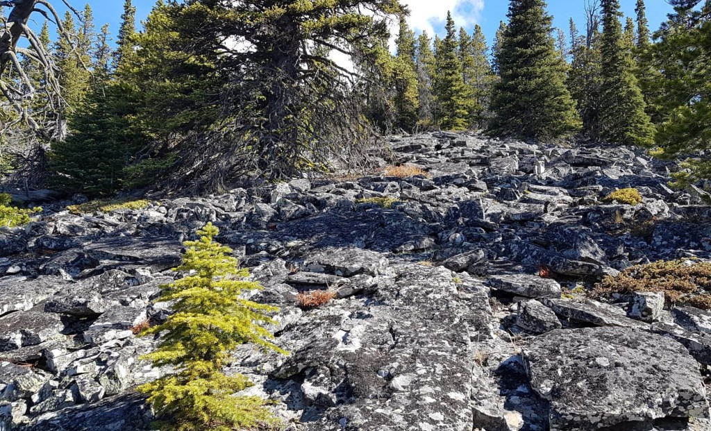
This shows the trail heading downhill towards the saddle. Be aware here. At times, the trail tried to drag us down to the left (north), which was the wrong way. Be aware of the direction of the summit, and check your bearings often.Once at the bottom of the saddle, the trees stop to reveal a lovely open slope. Head up the middle of it.Looking back down to the saddle. Junction Hill is heavily treed, effectively hiding its interesting rocks and topography. From here, the trail again enters the forest.Once again we are in the forest, which on a hot day is not a bad thing. The trail is faint on the rocky floor, but keep an eye out for the cairns that gently guide the way. Again, staying on the trail prevents trail braiding and damage. Photo credit: Sonya Laing.The forest turns into a unique talus slope. As Spirko says, this lasts for a surprisingly long time. What I absolutely LOVE about this slope is the size of the rocks and the amount of lichen. Most rocky slopes in Alberta are pure scree slog. Not here!
This may look like a field day for rock hopping, but there is indeed a ‘trail’ through here. It can be seen where the lichen has been rubbed off by previous feet. Try and stick to the trail and not erode this environment.
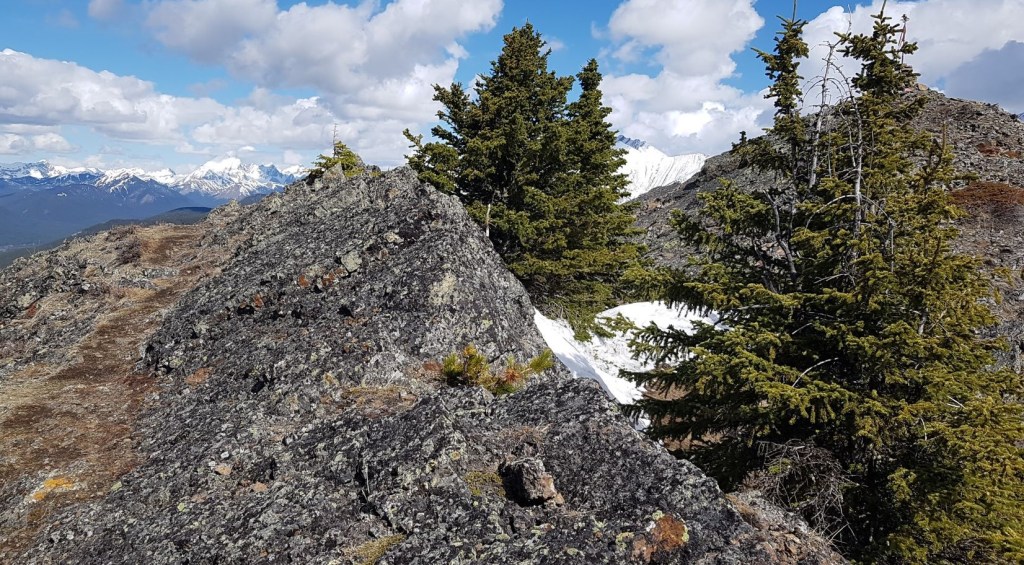
If you keep to the main trail on the talus slope, when the rocks end, you will find yourself here. This is a small ridge to get across and over. The other side will magically deliver the final summit trail.
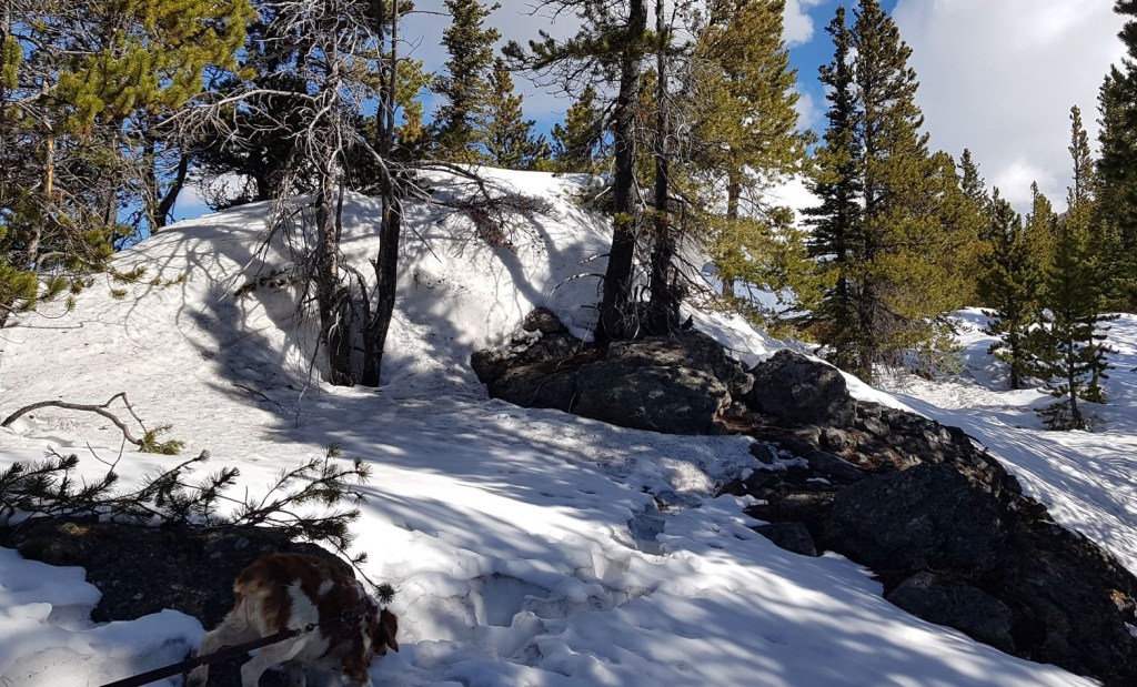
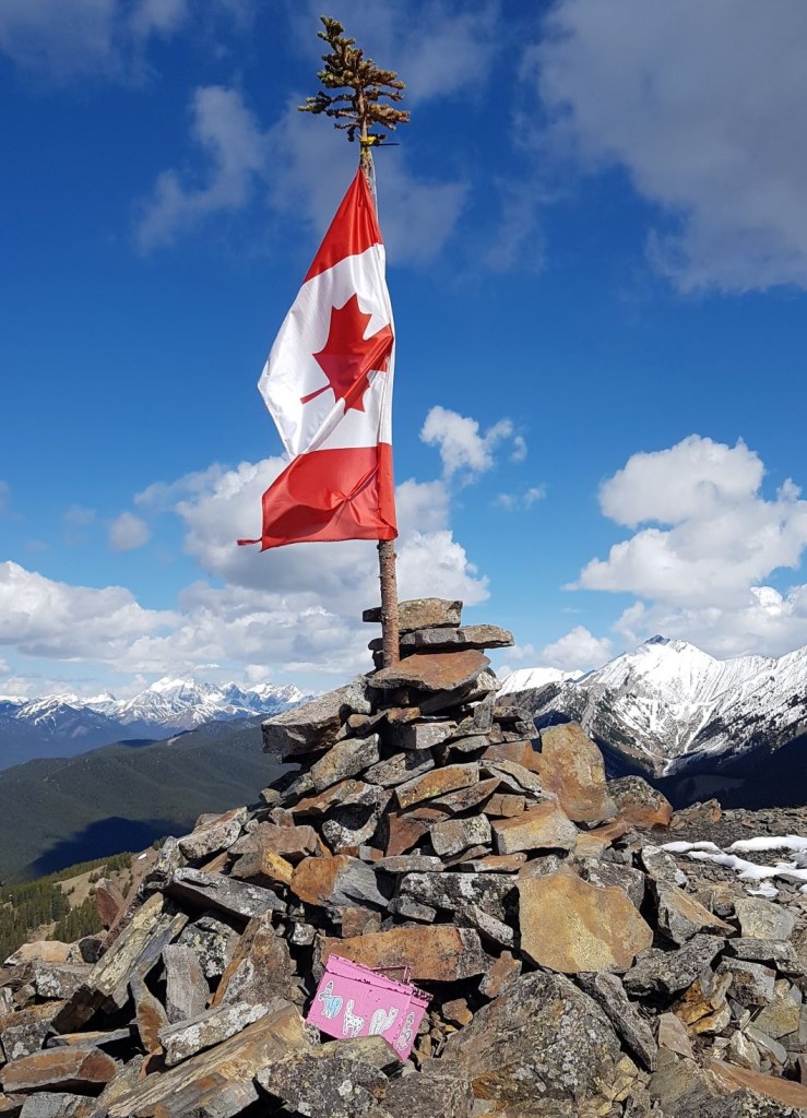
Even in mid-May, during a pretty dry year, we found snow. We were glad of the spikes and gators as the rotten snow was nearing my knees. From here, we headed straight ahead, and then found a way to cross over to the left side.The other side of the snow ridge is dry and beautiful. The final summit ridge is on the far right. The snow covered peak is Mount Head.The view of the actual summit comes into view. After so many wind-blasted days trying to get up here, we were SO happy to see the flag was lying limp. Aaaahhhhh…..There is a little downclimb before the summit. Follow the faint trail to the end of this rock outcrop, and then down climb from there. To continue the loop, this is also the way you come back. Instead of heading to the right, continue straight to pick up the narrow east ridge.I am captioning this photo “A woman and her dog”. Sonya and Pyro pose on the short downclimb.Making my way up the final slope to the summit. Photo credit: Sonya Laing.The summit of Junction Hill!!! After three previous attempts, I am SO happy to finally get here. There really was no reason for me to make this one so hard 🙂 However, I was overjoyed to find one of the Ephraim Roberts summit register boxes up here.
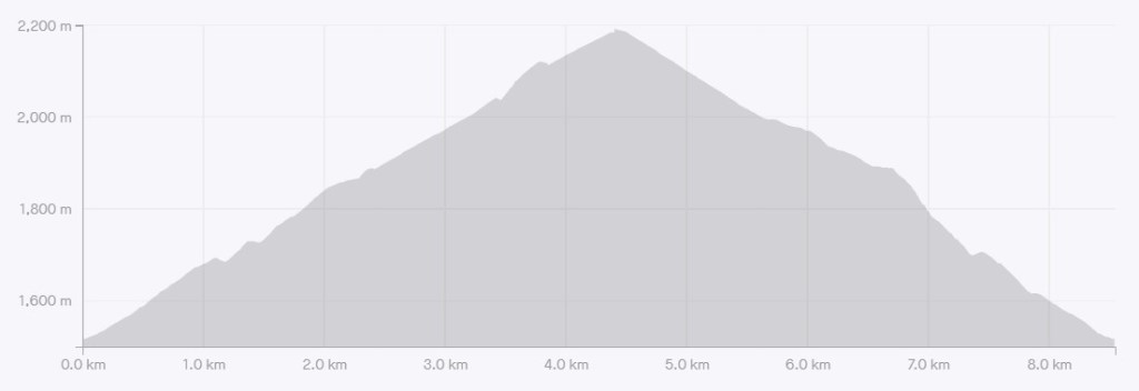
Distance to the summit of Junction Hill is approximately 4.4 km. Time was 2 hours, 25 minutes. Elevation gain is 719 m.
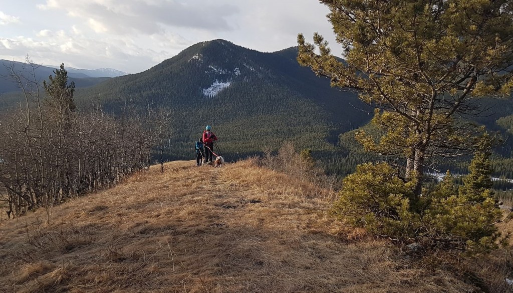
Interestingly, the Junction Hill summit is just a tiny bit of land. We shared the top with Jim, who hiked up the east ridge. There was just enough room for the three of us to stand up there. It is so tight, that when one of us took a 360 degree video, the other two had to walk in a circle behind them to stay out of the shot.
Junction Hill Return
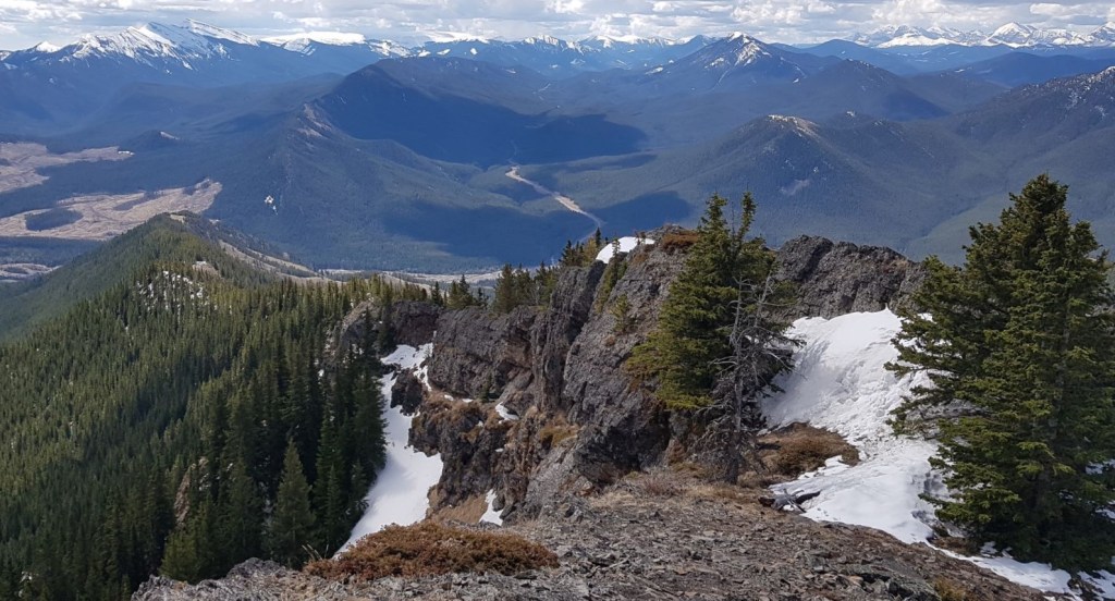
From the summit, you can return the way you came, but the full meal deal is to continue the loop, heading down the east ridge. This is a much more straight-forward route, as the trail is confined to a narrow ridge. What the trail lacks in route finding, it more than compensates in epic beauty. I could have included a dozen photos of this beautiful ridge, but I figured I’d let you discover it all for yourself.
From the summit, go back up the short downclimb. From there, head left (mainly south) to pick up the east ridge. Continue down until you hit the turn off to the right that leads you off the ridge and down into open meadow. From the meadow, keep angling south west, aiming for the Highway 40 / Highway 941 junction.
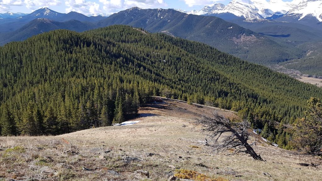
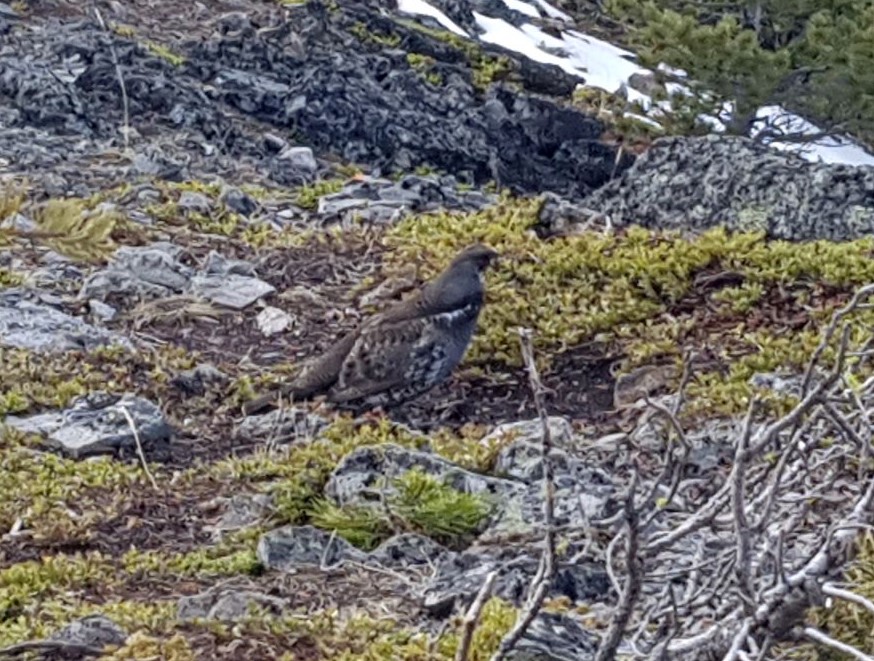
From the Junction Hill summit, looking back at the short downclimb. Go back up this little wall, then head left (south) to hike down the east ridge. The snowy peak on the left is Mount Burke. The snowy ridge on the right side of Highway 940 is Raspberry Ridge. The close ridge on the right is Coyote Hills. Across from Coyote on the east side is Hell’s Ridge.We found about 5 or 6 grouse on this trail, on both the west and east ridges. These birds use camouflage and staying very still as their main protection. Please keep your dogs on a leash at ALL times to protect these and other animals who live here. Photo credit: Sonya Laing.This ridge and views are stunning. On the left is Gunnery Mountain. Across the way is Mount Mann. The ridge does drop off quick steeply, but the trail is inland from the edge. The route off the ridge is the grassy slope below.This is the route off the ridge, and down the grassy slope. It is fairly obvious because the trail makes a sharp right hand turn and heads straight down this slope. You could continue straight here, and hike to the end of the ridge, and then descend that way. This is a bit shorter, and I think tends to be the preferred route because there was no defined trail continuing on the ridge.Once on the grassy slope, stay on the spine of the ridge, and follow it down. Avoid going down too soon and being drawn into the thick trees on the right.Looking back up at the ridge. Another option is to continue along the ridge, and then drop down on the far right.As we neared the end of the hike, we went through a sparse forest. Despite not having a trail since we left the ridge, we magically found the trail that would lead us directly back to the winter gates.The trail ends on Highway 40, just to the east of the culvert. Pyro takes a well deserved drink of fresh, cold water.
Junction Hill is an enjoyable hike that has it all. Fun route finding, forests, bare hills, a large rock slope, a very small scree section, a long and stunningly beautiful ridge, and open, grassy slopes. For such a small hike, I am impressed with the varied terrain and views.
If you found this post useful, please do me a huge favour and click the Star button to “Like” it. You can also follow my blog, follow me on Instagram, or join my FaceBook page Al’s Adventurers.
Alisen
Totals – Tracked on Strava
Date: May 14, 2021 Group: Two (Alisen and Sonya) Distance: 8.5 km Elevation: 719 m (2,373′) Time: 5 hours (includes lunch & breaks)
Junction Hill is located at the junction of highways 40, 541, and 940. Across the street is the Highwood House general store. The hike starts at the winter gates.Junction Hill makes a perfect elevation gain and descent profile. It is never too steep, yet elevation is always consistently gained or lost.
I love all things mountains! I live next door to the Canadian Rocky Mountains, however I travel the world to enjoy the many different mountain environments and cultures that I can. I hope you enjoy these trip reports, and that it inspires you to accomplish your own adventure goals.
I wrote that article because it seemed like Shoulder Season was a new concept to all kinds of people. In the past, only seasoned mountain folk were out and about and everyone just knew to stay away during these times. Now? It’s whoever can destroy the trail first.
I remembered specifically a Boy Scout camp my son and I attended in winter. Some of the trails looked exactly like some of the ones in this post. Overused, muddy, puddles of water, and getting wider by the day. I know it wasn’t shoulder season, but it’s a good reminder to maintain trails, even the ones in camps. Next time I have a chance, I will bring up the need to abandon that trail long enough to let it re-establish.
Yes! Once a trail is mud, it will be mud forever more. These mountain trails just don’t get enough of a growing season to get repaired on their own.
I like your idea to rotate trail usage, and allow some trails to go fallow until they dry up, and start growing vegetation again.
Another option is to install stone pavers or wooden walkways on high traffic trails. In Peru, ALL the trails, no matter how remote, have stone paths on either side of the water crossings. This way, no matter how much rain they get, the trail will stay protected and mud free. Good luck with the Boy Scouts camp trails. I sincerely hope you are successful.
Glad to hear that the wind didn’t keep you from reaching the summit this time. The views of the snow capped mountains at the peak looked like they go on forever in your video. I’m with you, I’d rather get the tough terrain out of the way at the start so that the return journey home is easier.
It was actually getting comical how many attempts I had. My hiking buddy’s husband actually asked “why does Alisen keep going back there?” It’s done now and that’s all that matters 🙂


Some of those photos are just epic. I had no idea. Also, thank you for introducing me to the concept of “shoulder season.”
I wrote that article because it seemed like Shoulder Season was a new concept to all kinds of people. In the past, only seasoned mountain folk were out and about and everyone just knew to stay away during these times. Now? It’s whoever can destroy the trail first.
I remembered specifically a Boy Scout camp my son and I attended in winter. Some of the trails looked exactly like some of the ones in this post. Overused, muddy, puddles of water, and getting wider by the day. I know it wasn’t shoulder season, but it’s a good reminder to maintain trails, even the ones in camps. Next time I have a chance, I will bring up the need to abandon that trail long enough to let it re-establish.
Yes! Once a trail is mud, it will be mud forever more. These mountain trails just don’t get enough of a growing season to get repaired on their own.
I like your idea to rotate trail usage, and allow some trails to go fallow until they dry up, and start growing vegetation again.
Another option is to install stone pavers or wooden walkways on high traffic trails. In Peru, ALL the trails, no matter how remote, have stone paths on either side of the water crossings. This way, no matter how much rain they get, the trail will stay protected and mud free. Good luck with the Boy Scouts camp trails. I sincerely hope you are successful.
Glad to hear that the wind didn’t keep you from reaching the summit this time. The views of the snow capped mountains at the peak looked like they go on forever in your video. I’m with you, I’d rather get the tough terrain out of the way at the start so that the return journey home is easier.
It was actually getting comical how many attempts I had. My hiking buddy’s husband actually asked “why does Alisen keep going back there?” It’s done now and that’s all that matters 🙂
Ha! Gotta love your persistence and dedication. I’m sure it felt so rewarding to (finally) complete this hike after a few failed attempts.
Thanks! I appreciate your adjectives. Insane and stupid could also been used 🙂 🙂 🙂
Wonderful ‘off the beat’ photos and adventures of your hiking, walking, nature trips, bird watching and Junction Hill summit reaching!
Thank you! I love seeing these adventures through other people’s eyes. Glad you enjoyed it!