June 19, 2022
I have a rule. I must hike for at least as long as I drive. As it’s a four hour round trip drive to Spray Lakes, this has kept me from doing Little Lougheed as the distance/elevation wasn’t worth the drive. However, as my buddy Erin had it on her “list” that we’d been working through, I finally decided to go for it. As we played around in the rock garden, and then had a leisurely summit lounge enjoying the view of Mount Lougheed, total time turned out to equal driving time. Win – win!

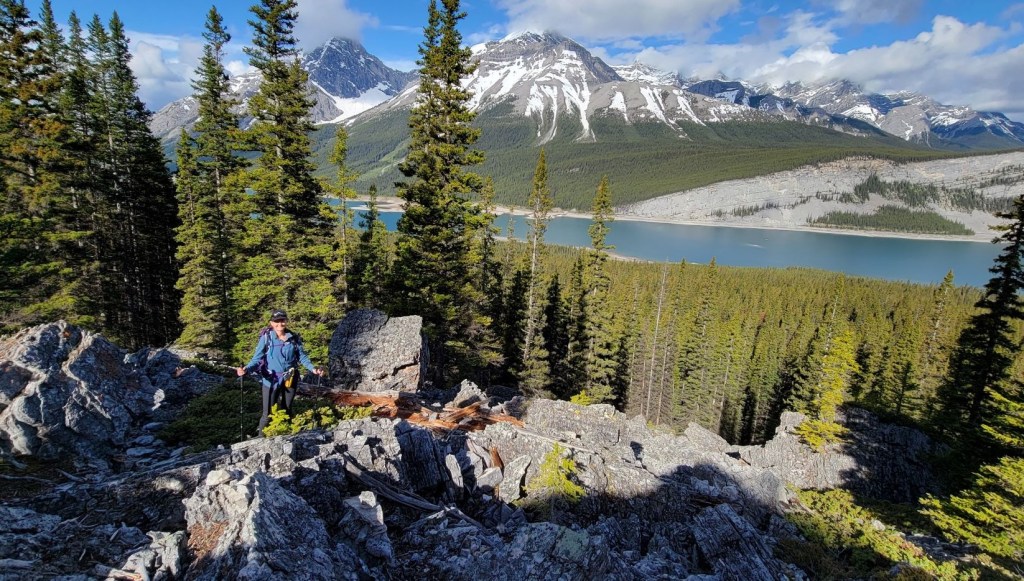
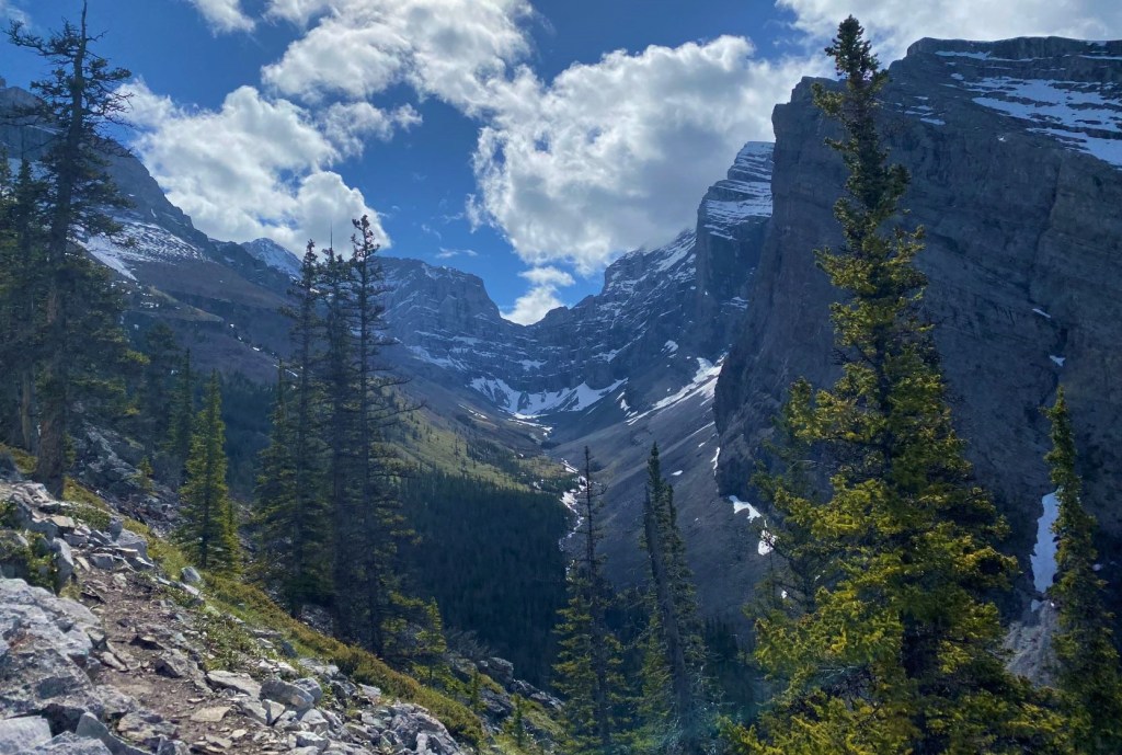
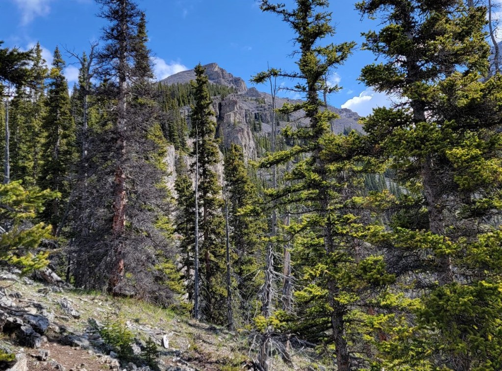
Little Lougheed is a popular winter destination, however I think the summer route is excellent fun as we could enjoy the otherwise buried rock garden. I did make one lucky navigation choice that got us off the rock garden and onto the main trail at just the exact moment I needed it. Luck or experience??? Once above the rock garden, it’s a straight-forward hike to the summit. The views are absolutely incredible at the summit and during the ascent. I’m so glad we had the visibility that we did.
Gear
Hiking boots, poles and regular day pack kit.
If going in the winter, add in gaiters and microspikes. I’ve not done this in the winter so don’t have a read on all the winter hazards. Be aware of the open slope to the summit. Being swept down into the trees, or off to climber’s right into the creek drainage would both be brutal.
Overview
From the highway, hike up the trail. Turn left at the High Rockies Trail, then right to access the Little Lougheed trail. Head straight up, passing the boulder field, another forest section, and the final scree to the summit. Return the same way.
Here’s a short video of the Little Lougheed summt.
Totals – Downloadable Tracks on Gaia, Displayed on Strava
Date: June 19, 2022
Group: Two (Alisen and Erin)
Distance: 5.6 km
Elevation: 745 m (2,459′)
Time: 4 hours 0 minutes (includes rock hopping and summit lounge)


Parking and Trail Head
The Trailhead is 1.5 km north of the Mount Sparrowhawk/Reed’s Tower day use area. It is 2.75 km south of the wide West Wind Pass pull out. Look for the yellow direction sign on the east side of the road, just north of the wide creek basin.

Main Trail
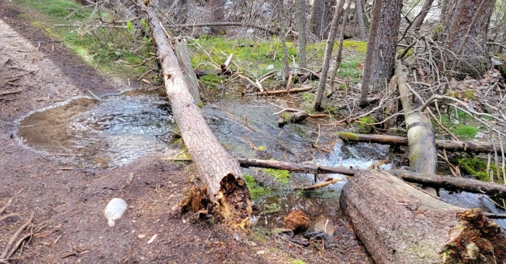
From the Smith Dorrien highway, start hiking up the trail. It’s a lovely forest walk for the first bit. As it was a really late spring, I was careful to pick dry routes. I was then surprised to see the trail was running with water, with parts of the trail blocked with yellow tape. The mystery was soon solved.
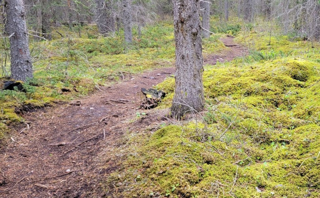

Once past the bubbling spring, we crossed a little bridge to access the High Rockies Trail heading north (left).

Around 800 m from the trail head, I found the trail to Little Lougheed on the right.

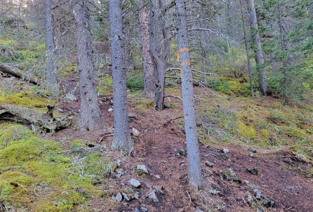
Once on the main Little Lougheed trail, it’s a straight up effort through the trees.
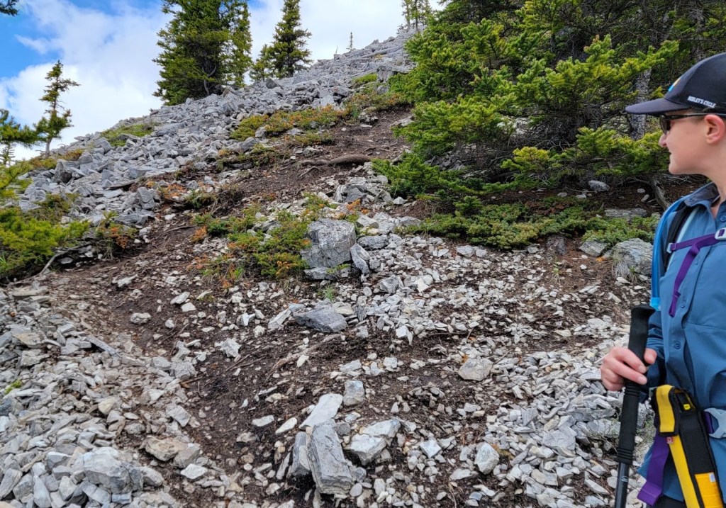
About 400 m up from the High Rockies Trail, we hit the rock garden. I was SO happy to see this as it brightened up an otherwise typical K Country forest hike. We decided to explore a bit, and headed off to climber’s left, following whatever struck as a good way up.
To AVOID this, stay to the far right of the bolder field, next to the forest. Especially in winter, I imagine most people stick to the trail beside the boulders to avoid slipping between the rocks and getting injured. I came down this way, and it is just fine.

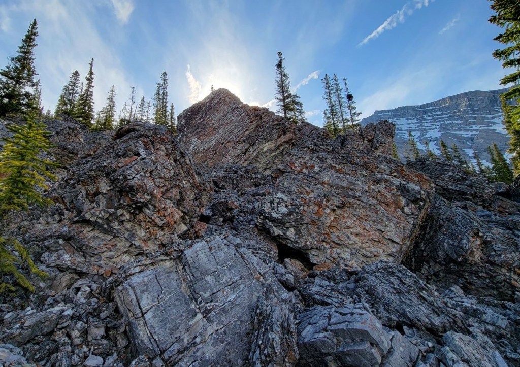
I saw a fun rock arch. We decided to go through it, and scramble up the inside. This was the stroke of good luck, as the top of this popped us out onto the main trail, exactly at the spot where I most needed to reconnect with the trail.


Once on top of the rock arch, I realized that we had more or less popped out on the trail. From here, we followed a trail through small boulders. We went past a couple sizable rock pinnacles, and then re-entered the forest for a bit.
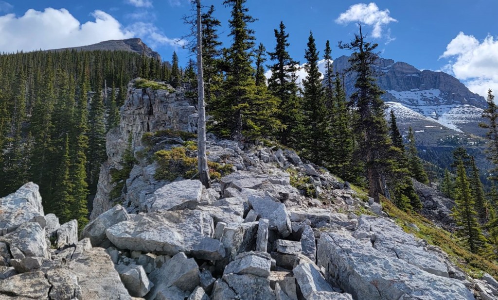

Once above the rock pinnacles, the trail turned into the forest for a bit.

Once we left the forest, we had the obligatory scree slog to the summit. I was pleasantly surprised by how little scree there was to hike, and by how little it sucked. It was actually an enjoyable hike to the summit ridge.

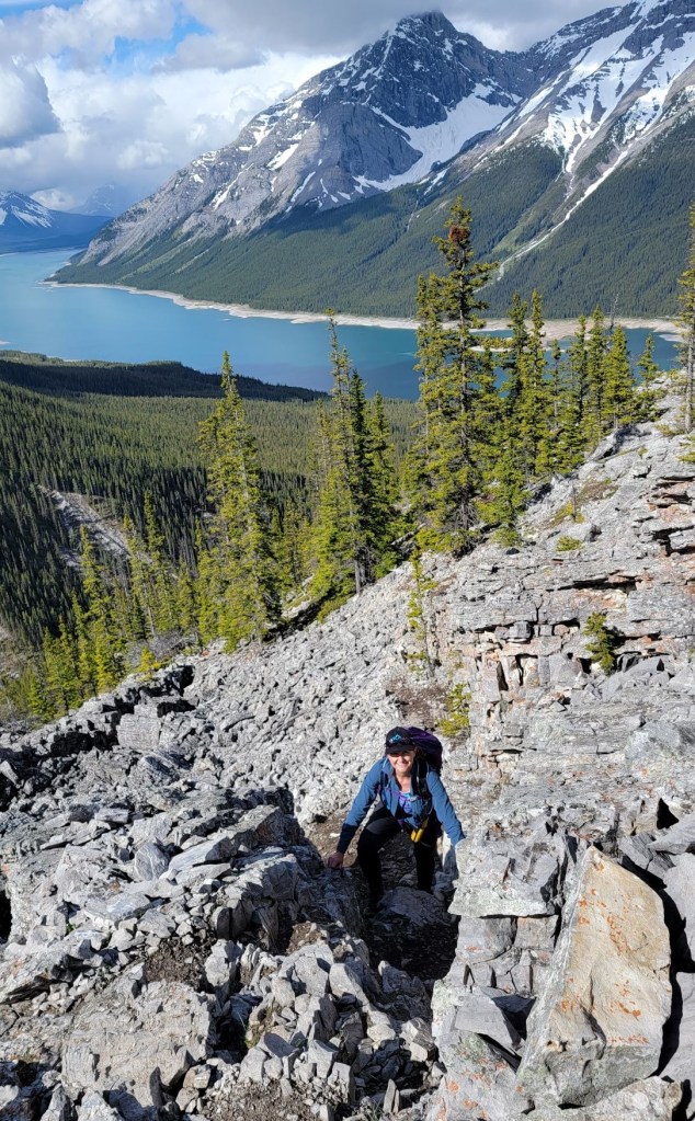
The summit of Little Lougheed was absolutely amazing. It’s not often that I want to summit lounge, but this little mountain really did encourage it. The views of Mount Lougheed were awe inspiring. I just couldn’t stop looking at this massive mountain. It really is impressive. We were up there so long, that as we were leaving, a couple came up and said they saw us ascending, and then wondered what happened to us because we didn’t come back down. I encouraged them to lounge as well.
Time to summit was 2 hours and 10 minutes. Distance was just shy of 3 km, with an elevation gain of 745 m.


Little Lougheed Return
After a good lunch and summit lounge, Erin and I booked it down the trail. After the scree and forest section, I was careful to stay on the main trail, and to go skier’s left to stay on the trail and not wander back down into the rock garden. This proved to be easy, as the trail is beaten in fairly well. What was a meander on the way up, was a fast scoot on the way down.


To be perfectly honest, I thought Little Lougheed would be a typical Kananaskis summit with not much in the way of beauty or exciting terrain. I absolutely loved this trail. The views were epic and the trail was as exciting as you wanted it to be.
Thanks for reading! Please do me a huge favour and click the Star button to “Like” it. You can also follow my blog, join my FaceBook page Al’s Adventurers, or follow me on Instagram
Alisen
I love all things mountains! I live next door to the Canadian Rocky Mountains, however I travel the world to enjoy the many different mountain environments and cultures that I can. I hope you enjoy these trip reports, and that it inspires you to accomplish your own adventure goals.

Those views 😍 Looks well worth the long drive, even if it was a slightly shorter hike. (I have the same rule… but sometimes you just have to make an exception.)
You’re absolutely right – rules are meant to be broken 🙂 Now I have to figure out a way to summit the actual Mount Lougheed. It’s an intimidating mountain, for sure.
wonderful
▪◾◼◾▪▫◽◻◽▫▪◾◼◾▪▫◽◻◽▫▪◾◼◾▪
▫◽◻◽▫▪◾◼◾▪▫◽◻◽▫▪◾◼◾▪▫◽◻◽▫
Great trip and video (music too)!
While reading your trip report I realized the trail looks familiar. I checked my saved tracks and, yes, we were there on July 10th 2022, we almost bumped into each other 🙂
This is a nice trail, it gets you in little time, from highway level to the alpine environment.
Oh! That’s too bad. We definitely should have gone together. Did you play around in the rock garden?
We need to get together and do a winter ski. Maybe some light touring somewhere.
Absolutely!
That is a good rule. You might as well make the hike worth the drive. This looks like an adventurous trail, especially as you got to explore the rock garden. The views from the summit look stunning.
In the end, it was totally worth the drive 🙂 Who knew LOL!
And another enjoyable Hike Done and memories. Unforgettable – bloody good.
Looks like a beautiful place! Thanks for sharing your experiences. 🙂
Thanks Mark. It was a great day in the mountains 🙂
looks awesome.. thanks for the hike.. I’m had butt in chair or running after contractors and clients for 4 days but I’m getting out now that you’ve inspired me. 🎄❣️
Oh, I know all about Butt in Chair life. Sigh… It’s been -30 for DAYS and I’m going stir crazy. It’s now a balmy -25 and that is looking SO good right about now 🙂
Heh, I knew I’d started to adjust to living here in Prince George when the temps rose from -40’s to -10’s after that nasty arctic outflow we just had, and I was quite comfortable going out in such ‘mild’ weather! 😀
-40…. good lord… 🙂 People just don’t realize how cold that really is! I wish it would stay a nice even -10 to -15 all winter long. Is that too much to ask??? 🙂
I’ve discovered I don’t mind it being that cold, it’s how quickly the temperature shifts that gets me in ‘me arthriticals’, ie my joints. 😀 … and unfortunately, that seems to be how our weather systems are shaping up in these ‘interesting times.
❄🧊⛄🌿🎄🕯🤍🕊🎁🎉🥂✨