June 5, 2015
July 8, 2022
I’m not sure why there are two mountains with nearly identical names within kilometers of each other… I’ve been caught referring to the wrong name on more than one occasion, so forgive me if you already know this. Mount Baldy is the scramble that is closest to Yates Mountain/Barrier Fire Lookout. Old Baldy Peak is further south on Highway 40, south of Kananaskis Village. This is a trip report for Old Baldy Peak, which can be a long day hike or extended to scramble up to the summit.
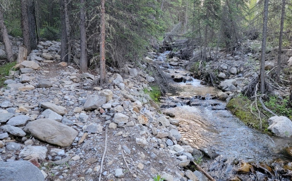
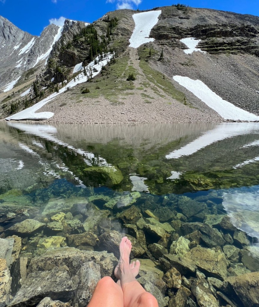
At one time, Old Baldy was a popular hike. After the 2013 floods rearranged the creek bed and washed out most of the trail, it’s no longer on the radar. I originally hiked Old Baldy with Annette in 2015. What a frustrating hike! We took the lower creek trail, which was obliterated by the flood. We went back and forth across the creek endless times, usually on logs or whatever debris we could find. It took forever! I was following the route description in Daffern’s guidebook, but as the ‘trail’ was non-existent, and this was before GPS, I couldn’t even tell if I was on the right track. I was so close to giving up when we popped out of the trees to see the gorgeous tarn at the base of the mountain cirque.
I wanted to come back and finish what I started. This time, I was eyeing the full summit scramble to the top of Old Baldy Peak. Sonya agreed to come with me, and leave Pyro at home. Wow. She must have really missed me to do that 🙂
Hikers
If you want to hike Old Baldy, I’d highly recommend taking my route and making a loop. Go up on the ridge side to the wide plateau, and then descend at the col (where the Rocky Mountain Sheep were seen), and return on the creek trail. Follow this trip report, but omit the scramble to the summit.
Gear
Hiking boots, poles and regular day pack kit. If going for the summit scramble, add in a helmet.
Overview
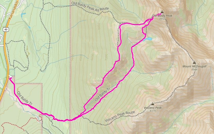
From the Evan Thomas day use area, hike the main trail to the twin cairns to access the McDougall Creek trail. At the Y junction, we took the left trail up to the ridge. We hiked a large boulder field, then hiked along a flat meadow that lead to a cone-shaped hill. We traversed around the hill, which lead to the wide flat plateau of Old Baldy. Hikers can descend at the col, hike down to the lake, and return on the McDougall Creek trail.
Scramblers can continue up the other side of the col, keeping to the ridge. Cross the prominent rib, and ascend to the summit. Return the same way. After crossing the rib, take the scree slope back down to connect with the hiker’s trail back to McDougall Lake. Return via the McDougall Creek trail.
Video
I usually include a small video, at least a summit panorama, but I decided to create a full video. Take a look, and let me know what you think.
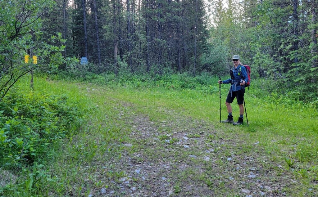
Parking and Trail Head
Parking is at the Evan-Thomas Day Use Area.
The trail starts to the right of the outhouses, at the obvious wide track with the numerous signs. Hike for about 100 m, then turn left to pick up the main trail.

Main Trail
Follow the super wide trail for about 1.8 km from the parking lot. At the Y junction, turn left at the “Trail Not Maintained Beyond this Point” sign. It’s possible to go either way, but this seemed shorter.

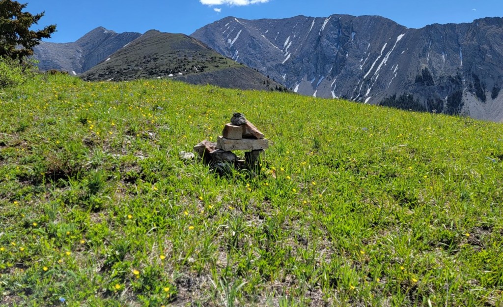
At 2.2 km, look for the double cairns marking the entrance to the Old Baldy Peak trail. Going straight leads to Evan-Thomas Creek, so if you hit water, backtrack 100 m.

The trail now parallels McDougall Creek, which starts at McDougall Pond at the base of Old Baldy. This section of the trail is beaten in quite nicely, and I was almost suckered into following it again all the way up. When I saw the side trail heading up the alternate ridge route to the north, I told Sonya that I didn’t fully trust the lower trail, and that we could easily make a loop and come back on the creekside trail.
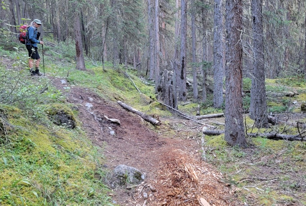
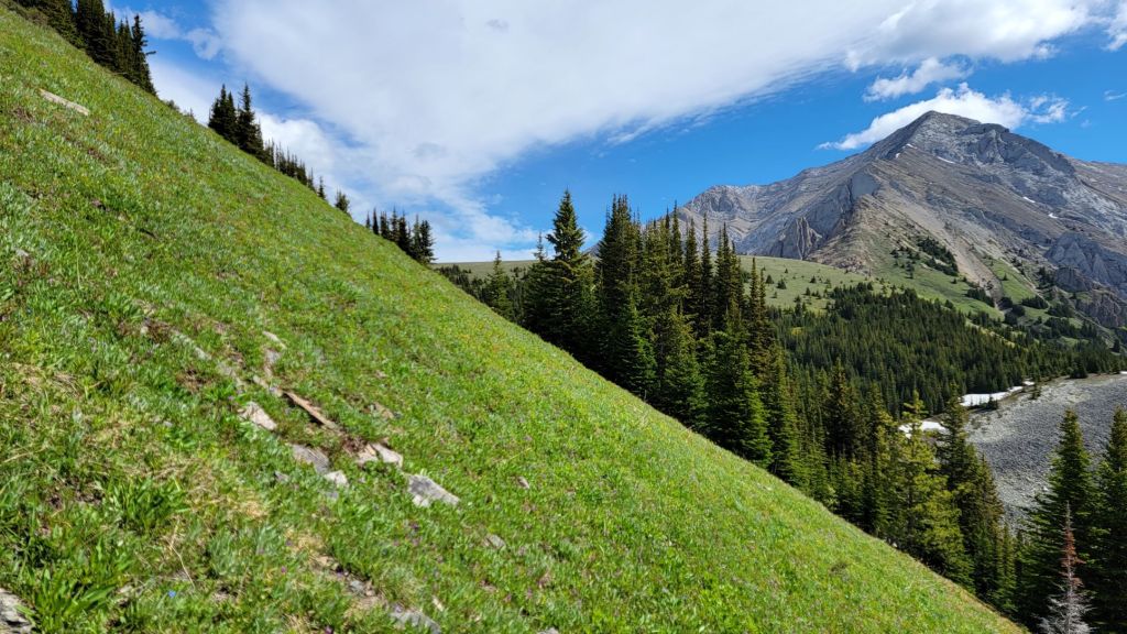
Despite the initial section of this trail being super steep, I was SO happy we took the upper ridge trail. We found a massive rock garden, gorgeous cliffs, views of the surrounding mountains, and a trail that didn’t drive me insane with its dipsy-doodling. The trail lead to the plateau where most hikers will end their hike and turn around.
We hiked through a short section of forest, and came to a large rock garden. There were several cairns along the way, as well as disturbed rocks, to guide us through.


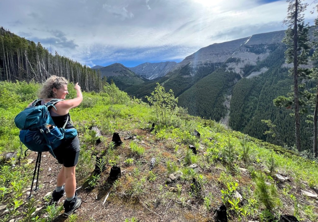
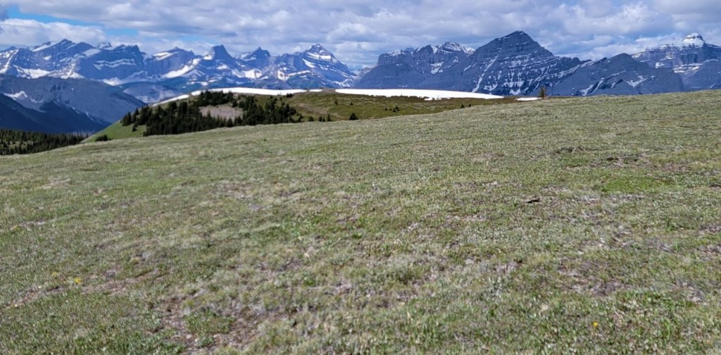
We then came to the most amazing ridge that seemed to extend forever. Such gorgeous views that you just don’t get from the creek trail. After the ridge, the trail peters out on a flat plateau. That’s okay though, because there is a massive volcano-shaped hill to aim for. Once past this, it’s the famous Old Baldy from Daffern’s guidebook.


The trail on my map looked like it went straight up and over top of this hill, but we found a side trail that went around the base to the right. We continued this trajectory around the hill, and then hiked up to the wide flat Old Baldy plateau.

Hikers Return via McDougall Creek Trail
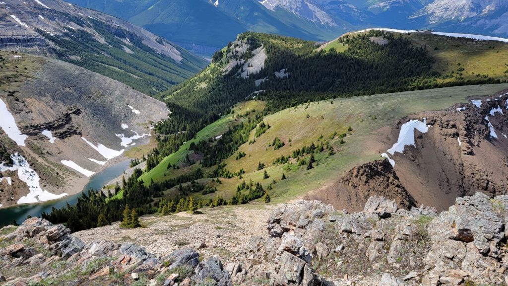
We hiked along the top of the Old Baldy plateau, and then descended to a col. At the lowest point is the ideal spot for hikers to go straight down. It was here that we saw a lone female hiker who had come up the creek trail, but stopped well below the col. There was a herd of Rocky Mountain Sheep, which got up and travelled over the other side of the col.
Keep an eye out for the trail that leads down to the tarn below. See below for photos/description after the summit scramble info.


Old Baldy Peak Scramble
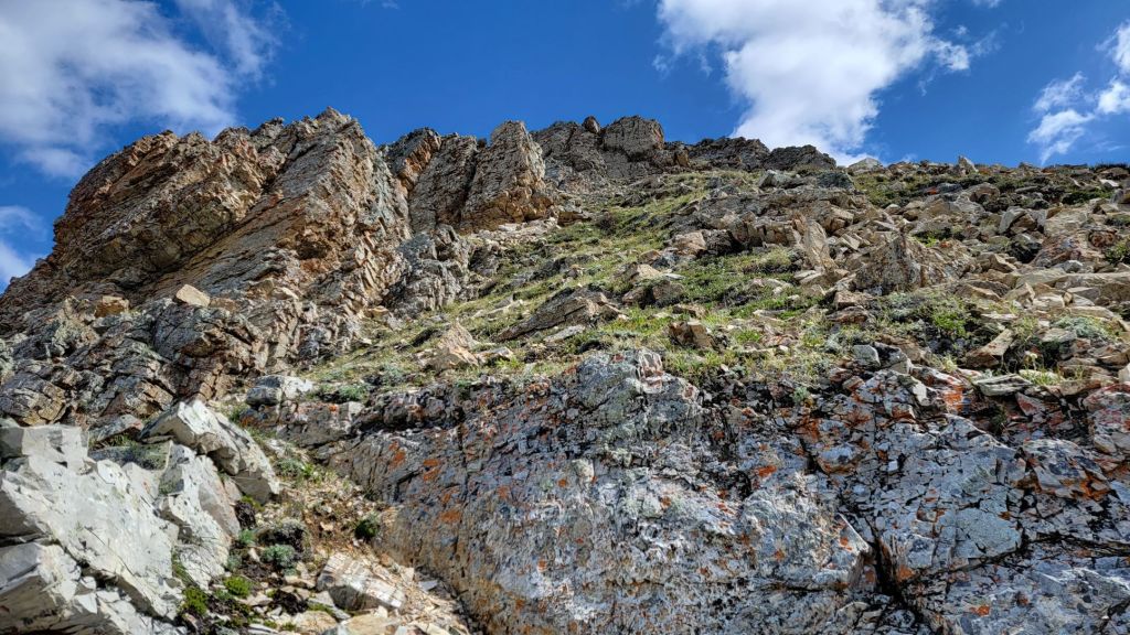
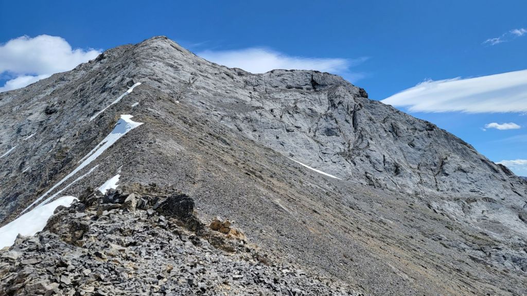
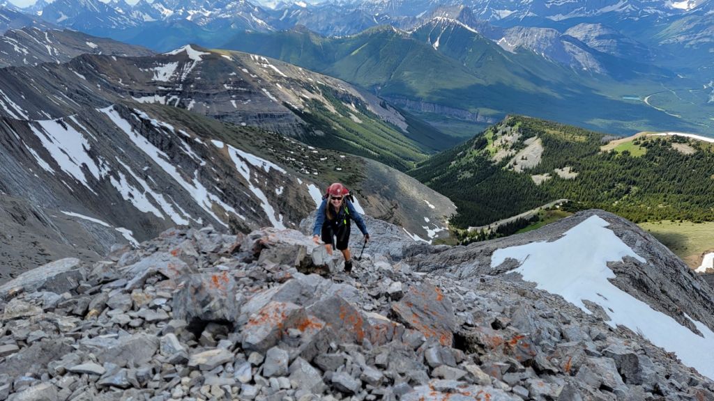
After dropping down to the col, we started to hike back up the other side. The initial going was a churning scree slog, but the gorgeous red rocks and views greatly improved the trail. I elected to go high and gain the ridge, both for the fun scrambling, but also to get away from the scree.

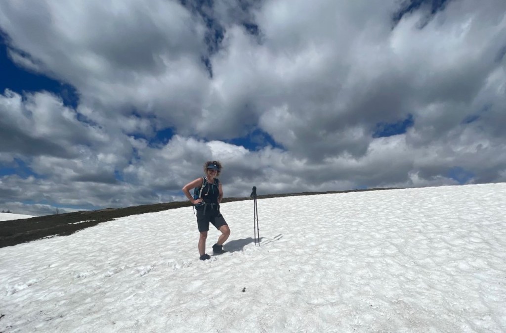
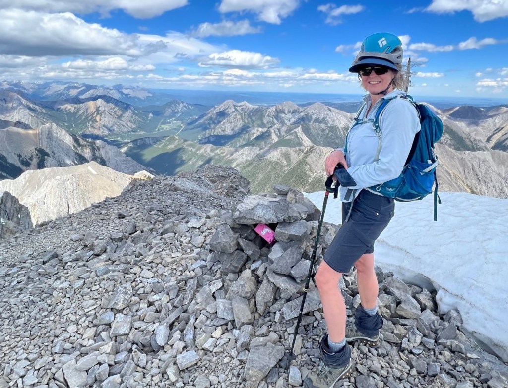
We followed the ridge as far as possible, then went right. We crossed a wide scree slope, and went over a prominent rib. Once over the rib, it was a scree ascent to the summit. There was a nice trail to the col just below the summit, with an even nicer trail to the summit. Unfortunately, there was a block of snow in our way. I didn’t know if it was a cornice, so elected to stay right and instead scrambled up the loose scree directly below the summit. This was nasty, but doable.


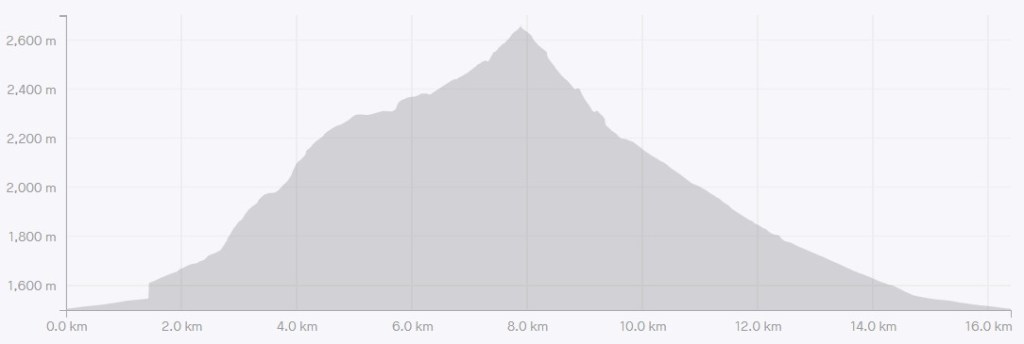
Distance to summit is 8.8 km. Elevation gain is 1,199 m. Time to summit was 4 hours, 45 minutes.
Old Baldy Peak Return
When leaving the summit, I could see that the snow block was not a cornice. Unfortunately, it was sun modified, with a bullet proof crust, and steep enough that a slip would send us careening down. Without an ice axe, the safest route was to go down the scree we came up. Ugh.
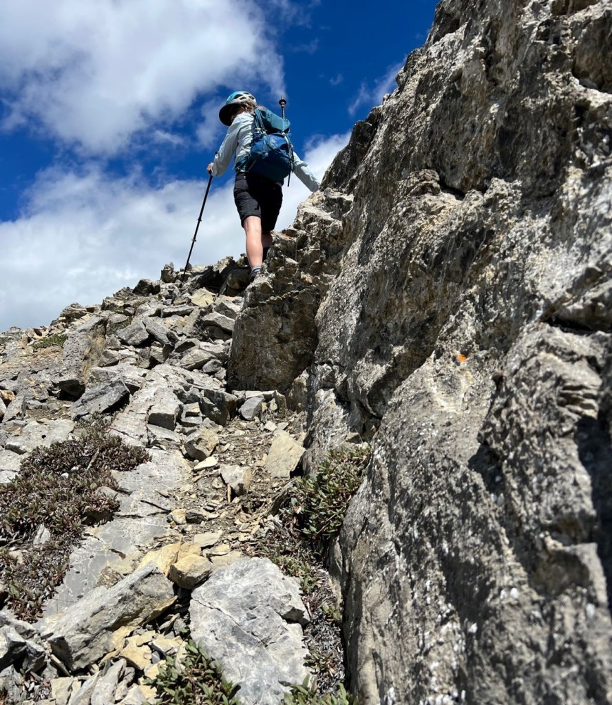
We retraced our steps for the most part. There was a section of sticky rock wall that was easy to scramble up, but gave a moment of pause on the way down.

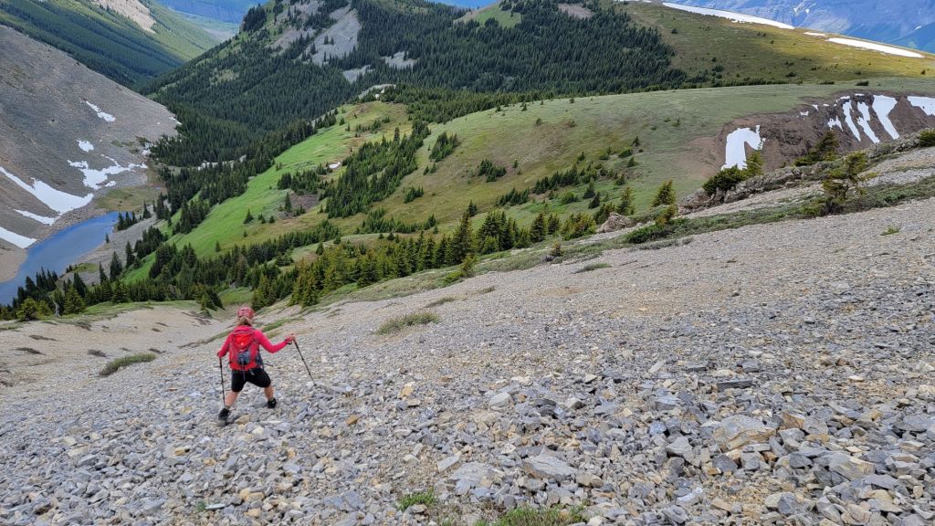
We crossed the prominent rib, and then beelined it down the scree slope. We veered off at a break, and went onto the grassy slope on the right. Here we took off our helmets, had a little bite to eat, and then found the trail heading down to the tarn.


A vocabulary side trail: Two people have now questioned the word ‘hummock’. Sonya asked if a hummock was the opposite shape to a hammock. I said yes. She then asked I had made up the word hummock. Nope! It’s a real word and a real thing – a small bump or rounded hill.

While it was a long day, I cannot resist the opportunity to soak my feet in a cold mountain tarn or stream. This was a much needed refresher before tackling the annoying creek side trail. While the trail was MUCH improved since my 2015 trip, it still dipsy-doodled back and forth. A few times we lost the plot completely, and had to punch our way through the bush to get back to the trail.


By the time we got back to the initial trail split with the upper ridge route, the trail was again solid. The hike back to the parking lot was long and boring.

I am thankful that I gave Old Baldy a second shot. I will admit to never being so frustrated with a trail as when I did the creek trail in 2015 with Annette. I’m glad enough people have been through to bash out a trail for the most part. However, I’m even more ecstatic to have found the upper ridge trail that provided so many views and interesting terrain choices.
Whether you want to hike a loop, or climb a peak, Old Baldy is a nice quiet place to get away from the crowds.
Thanks for reading! Please do me a huge favour and click the Star button to “Like” it. You can also follow my blog, join my FaceBook page Al’s Adventurers, or follow me on Instagram
Alisen
Totals – Downloadable Tracks on Gaia, Displayed on Strava
Date: July 8, 2022
Group: Two (Alisen and Sonya)
Distance: 16.2 km
Elevation: 1,199 m (3,957′)
Time: 8 hours 45 minutes (includes lunch and breaks)
I love all things mountains! I live next door to the Canadian Rocky Mountains, however I travel the world to enjoy the many different mountain environments and cultures that I can. I hope you enjoy these trip reports, and that it inspires you to accomplish your own adventure goals.

This looks awesome! I love the views from the ridge and summit, the tarn looks lovely, and the scrambling sounds fun. What a great hike!
Thanks Diana. It was a great day. I was tired of route finding by the time we got to the creek though. Best part? We had the mountain all to ourselves all day. That’s a rare thing in the Canadian Rockies these days.
That is rare! It’s nice to know there are still places to get off the beaten path.
How lovely Alisen!
Really nice post and how great to see the solitary rugose corals! I have never seen something like that before.
LONG before I started hiking, I visited Mount Olympus and Zeus’ tumbled temple. The large rings that make up the columns were laying down, and we could get up close and personal. The stone was made up of small fossilized sea shells. I thought at the time – who could not believe in evolution when the TOP of the mountain has sea shells from millions of years ago.
We are blessed with many spots with fossils, because of the way the Rockies were created. They were lifted up when a chunk of granite we call British Columbia rammed into the rest of Canada. The layers of the sea and lake beds were pushed up, exposing the layers beneath. Sometimes those layers were rich in plant life.
Hi. That’s a great hike. And I like your video. The panorama views from the summit are spectacular. Neil S.
Thanks Neil. No great philosophy here – just some grit and perseverance to get this mountain off my List.
That’s awesome that you were able to return and hike this trail again. I enjoyed the video recap. What a great way to compile your pictures. The rock band at the top of the ridge looks beautiful and I love how lush and green everything looks. How fun to even find fossils along the trail. I’m not sure how I’d feel about descending down on the vertical section of the rock. Thank goodness it wasn’t raining or anything.
Glad you liked the video. I’ve been wanting to do one for ages and finally had a Saturday free to just sit and do it.
Fossils are fairly common, but to find such a big one was pretty cool. Next time you’re here, you can book a tour to the Burgess Shale across from Field. Massive fossil deposits.
I’m glad you found the time. It’s a neat idea and a great way to showcase your pictures. We learned a bit about the Burgess Shale when we visited the Royal Tyrrell Museum in Drumheller. I didn’t realize that Yoho offered guided tours through the area until afterwards. This park just keeps getting better and better.
Wow what a fascinating hike. 🙂
Thanks. A long day for a summit but worth it.
Great links. 🙂
WOW! What a hike/scramble! I can’t believe how high those mountains are over there. No wonder you wear helmets. Thanks for the adventure, Mel
Thanks for joining me on the adventure Mel. This is not even one of the taller mountains, but the overall distance and elevation made for a long day.
Have an awesome day!
Alisen
You do mountains BIG in Canada!
It seems you enjoyed. And it looks a wonderful day for a hike. One day I’ll be doing this hike. Love it.
It really was a great day in the mountains. I hope you get to enjoy the nature in your own backyard.
Alisen
Thanks Alisen , definitely when the winter is over in Australia:) almost there 😀
Loved the video. 😀 … and reading your commentary here. 😀
That video was a lot of work. Not sure it was worth it. I’ll have to investigate different software and play around with different ideas.