July 3, 2023
The Rimwall is a mountain I’ve viewed from many directions. My first good look at it’s imposing wall was from Wind Ridge, and I thought to myself – nope! When I saw it from the summit of Windtower, it became a big fat yes! This view showed a long and tantalizing ridge line right to the summit. How could I refuse?
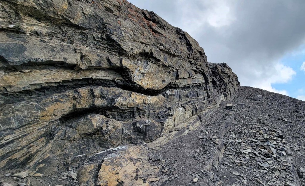
While this mountain is mainly scree, the trail was pounded in pretty good for most of it. There were a couple of easy scrambling sections, including two short walls right below the summit. I believe this route is pretty close to Kane’s “Scrambles in the Canadian Rockies” guidebook. However, this route missed out on the hardest scrambling, which is right above West Wind Pass. If you want the added challenge, see Spirko’s trip report.
We were here on a Monday, and there was only one other person on the mountain. We chatted as we passed, and then waited at the summit for him so we could take his photo.
Gear
Hiking boots, poles and regular day pack kit.
Overview
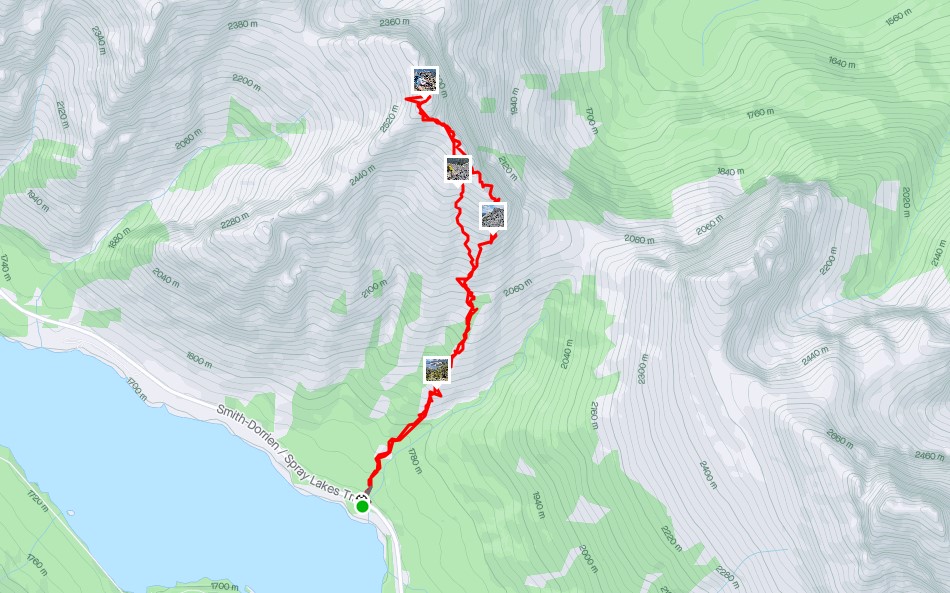
From the West Wind Pass parking pull out, cross the highway and start hiking up. Go straight up at the High Rockies intersection. At the Y intersection, go left for The Rimwall. Once out of the trees, hike through the limestone steps, and then hit the scree. Aim for the base of the ridge. Hike the ridge line. Near the summit, scramble up the two rock bands. It’s now a short hike to the summit. Return the same way, but cut off early on the ridge to take advantage of a soft scree descent. Rejoin the original trail as it enters the trees.
Totals – Downloadable Tracks on Gaia and on Strava
Date: July 3, 2023
Group: Two (Alisen & Mike)
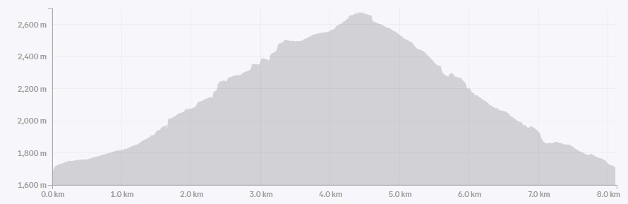
Distance: 6.5 km
Elevation: 946 m (3,122′)
Time: 4 hours 30 minutes (includes lunch and breaks)
Parking and Trail Head
The West Wind Pass parking is little more than a grassy slope across from the trail head. We backed in, and tried to get as far back as possible. The Smith-Dorian is a dry gravel road, and it’s nice to not come back to my car completely covered in white dust. For detailed parking and trail head, visit my West Wind Pass trip report.
We crossed the highway, and started hiking up on this well-used trail.
Main Trail
Almost immediately, we connected with the High Rockies Trail, and turned uphill (right) to gain the West Wind Trail. After about 700 m, we came to a Y junction, and went left for The Rimwall.
NOTE: Many a West Wind Pass hiker has accidentally gone left here, when they needed to go right. This direction means losing a titch of elevation, which seems wrong. As such, there’s usually a variety of flagging to help keep hikers heading in the right direction. I’ve met several people who have accidentally hiked half way up Rimwall before they realized their mistake.
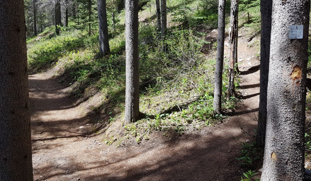
We continued up in the forest, enjoying the shade. The trail was fainter, but easily followed.
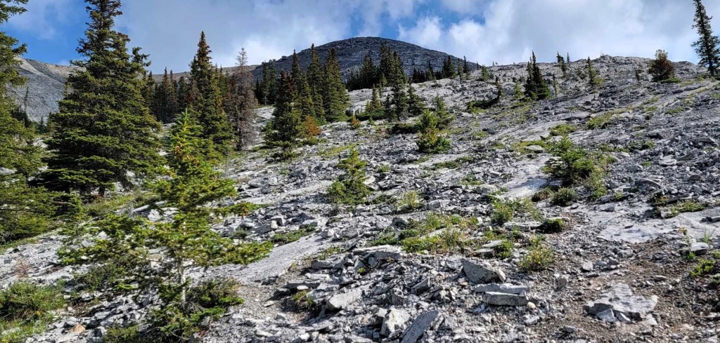
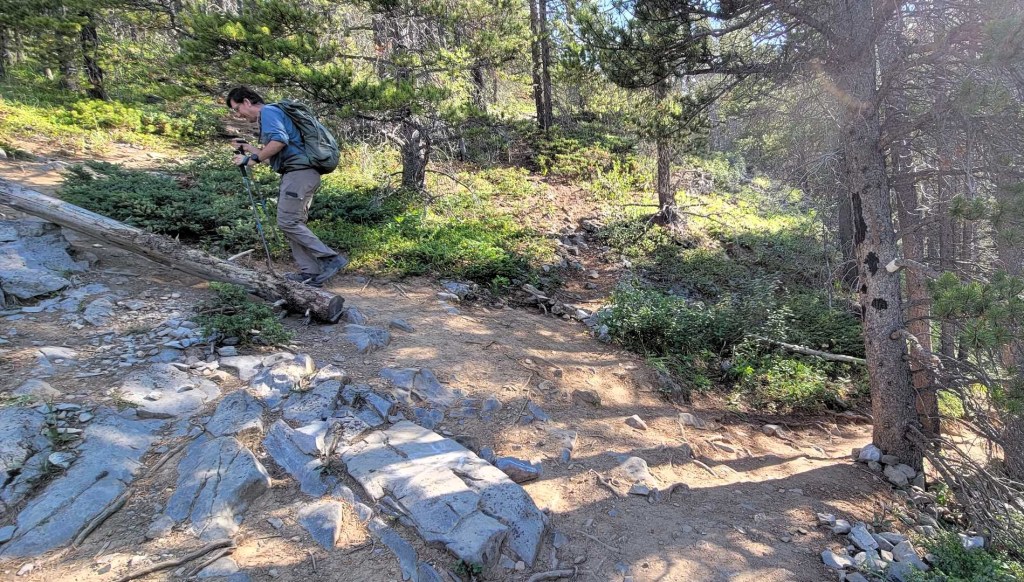
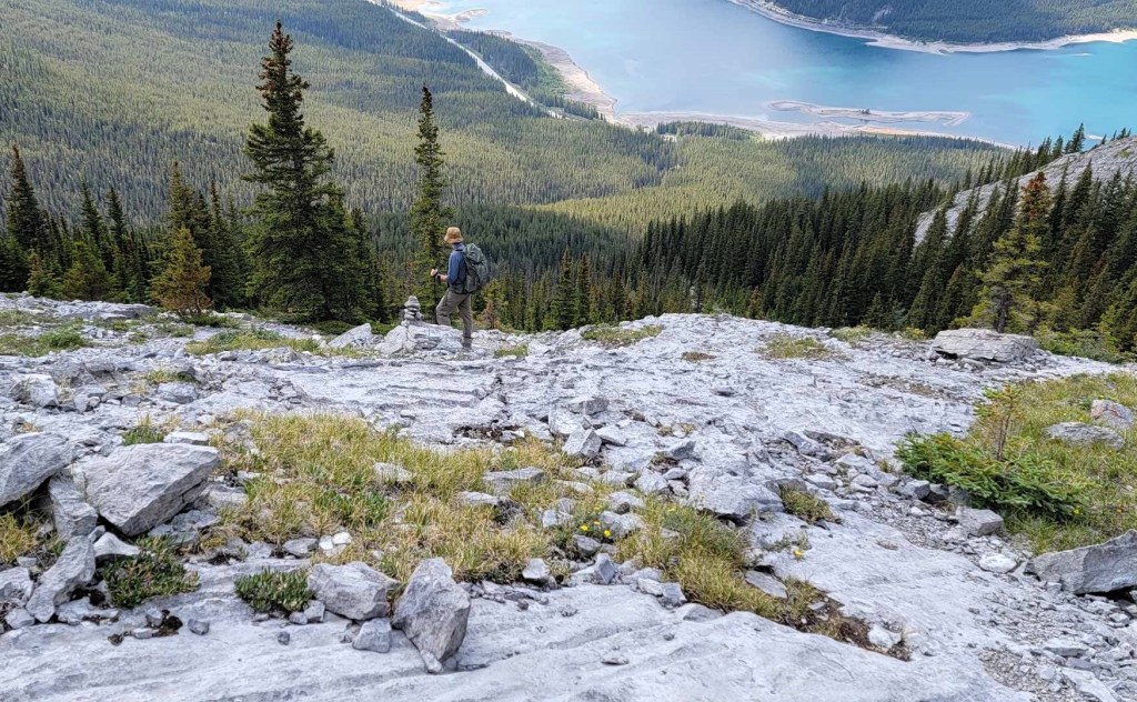
Once we got above the trees, we were met with a fun section of limestone steps. There were cairns through here, but it was mainly a Choose Your Own Adventure. It was here that we caught up with the one other hiker on this mountain. He called over to me “don’t follow me. I don’t know where I’m going.” No need to worry as I was on my own trajectory.
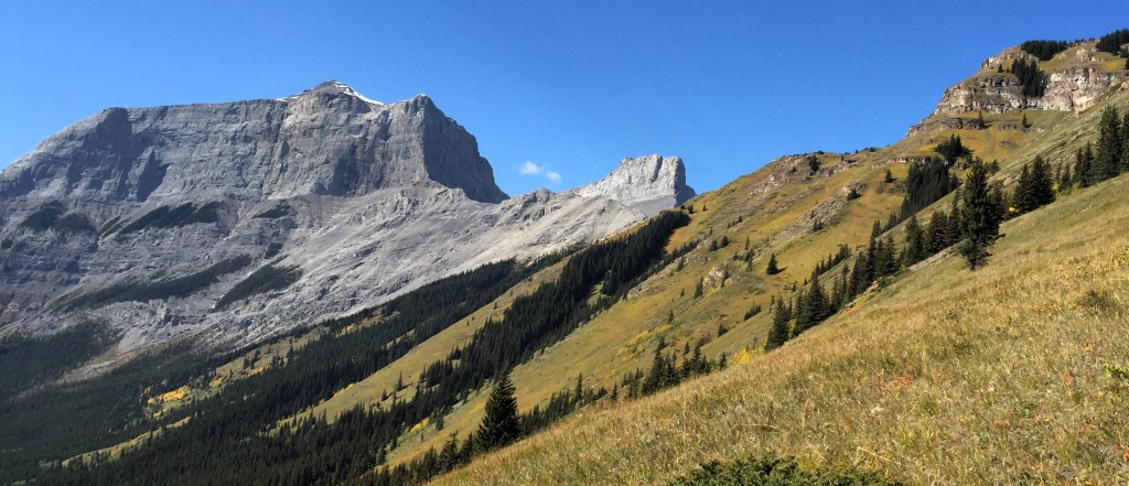
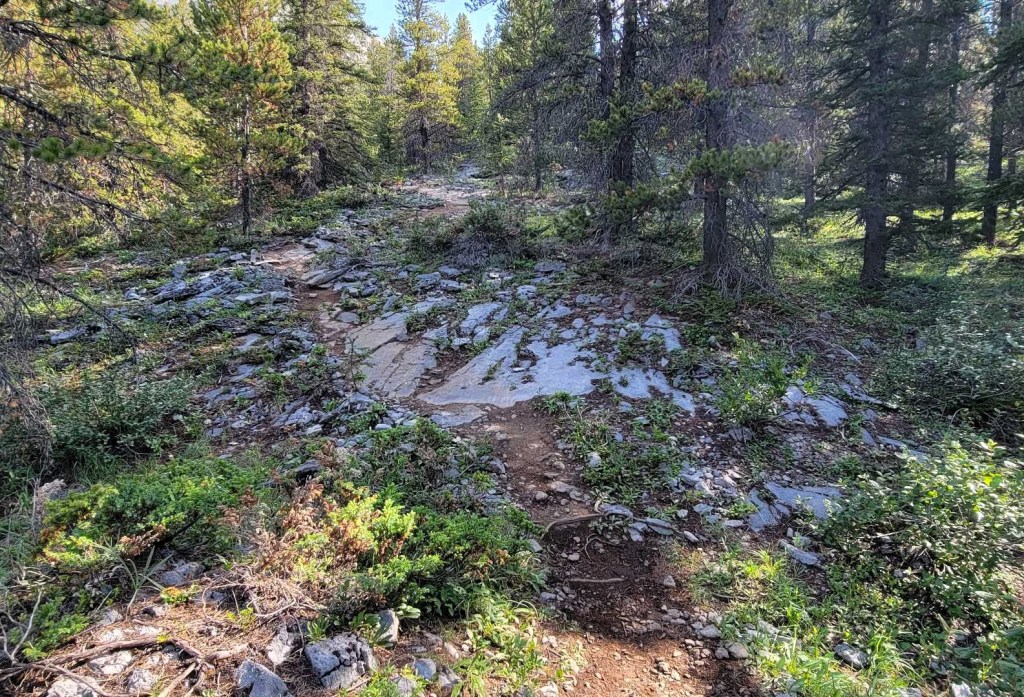
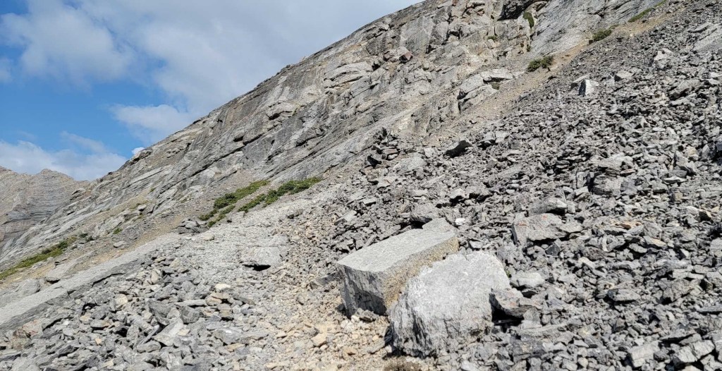
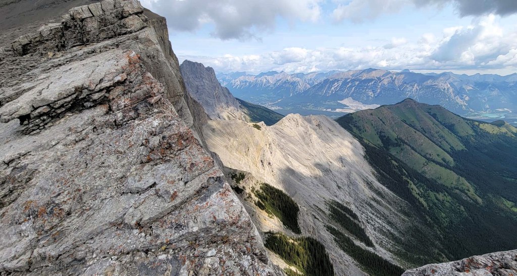
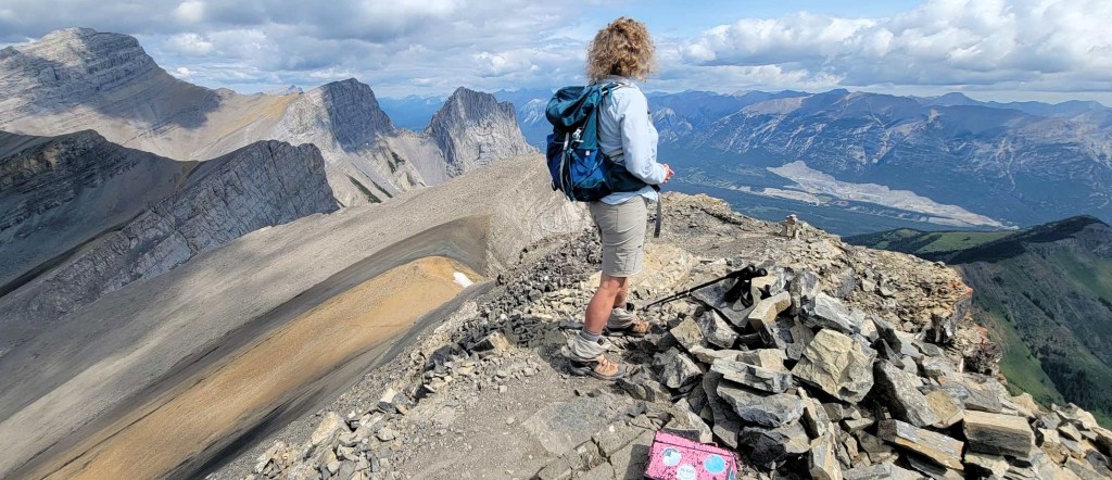
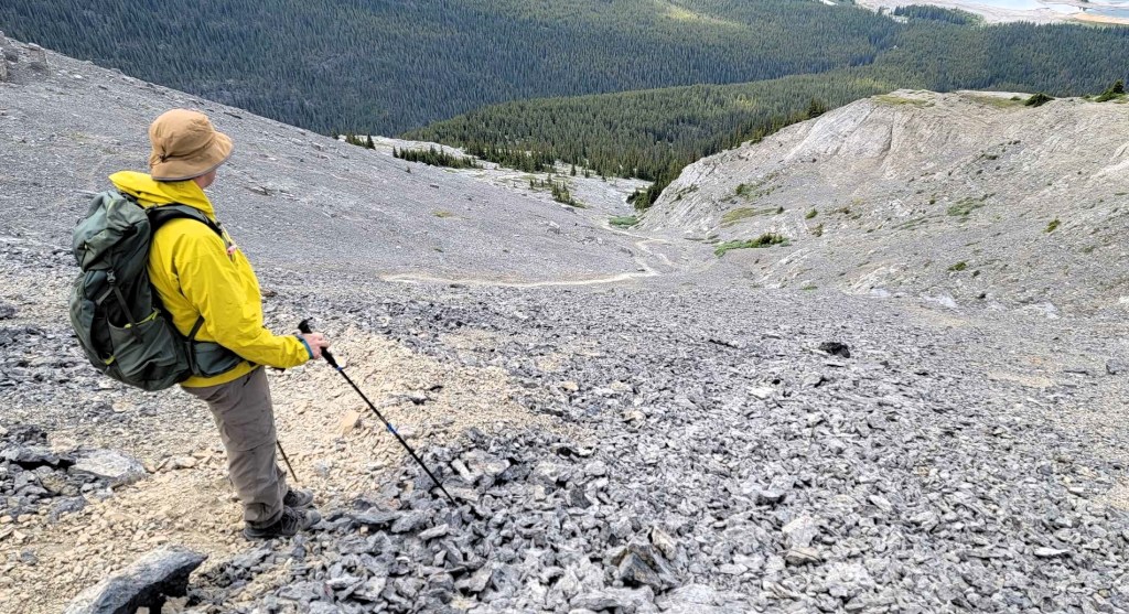
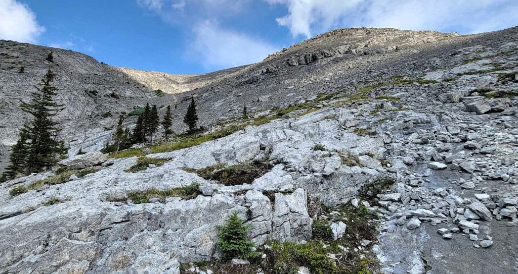
We left the limestone steps, and started up the scree. We immediately found an excellent trail that led up onto the ridge. From here, it was a really enjoyable ridge walk, with absolutely amazing views.
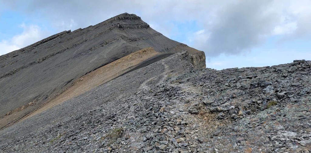
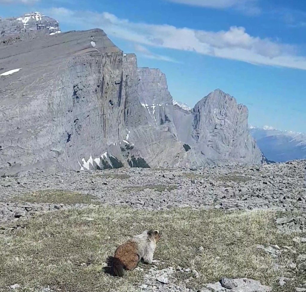
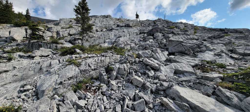
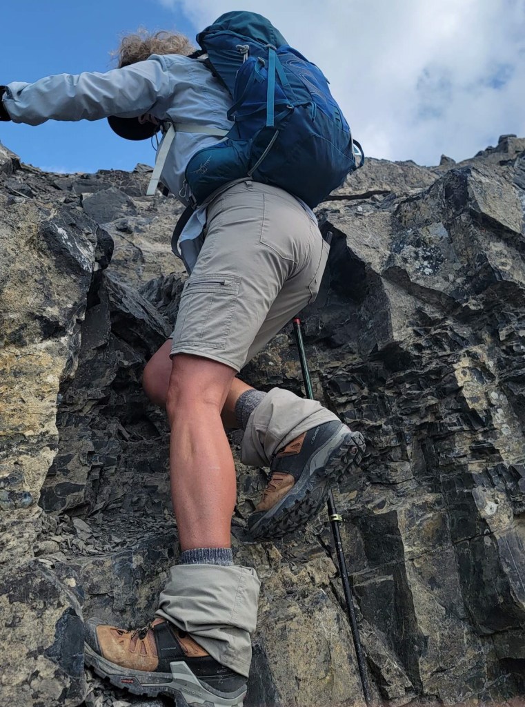
Just below the summit, there are two short rock walls. Kane suggests going left, but also offers the right side if conditions are dry. I didn’t like the thought of hanging out over the 1,000′ drop, so we went left. The two short walls add a titch of fun scrambling for an otherwise tame route.
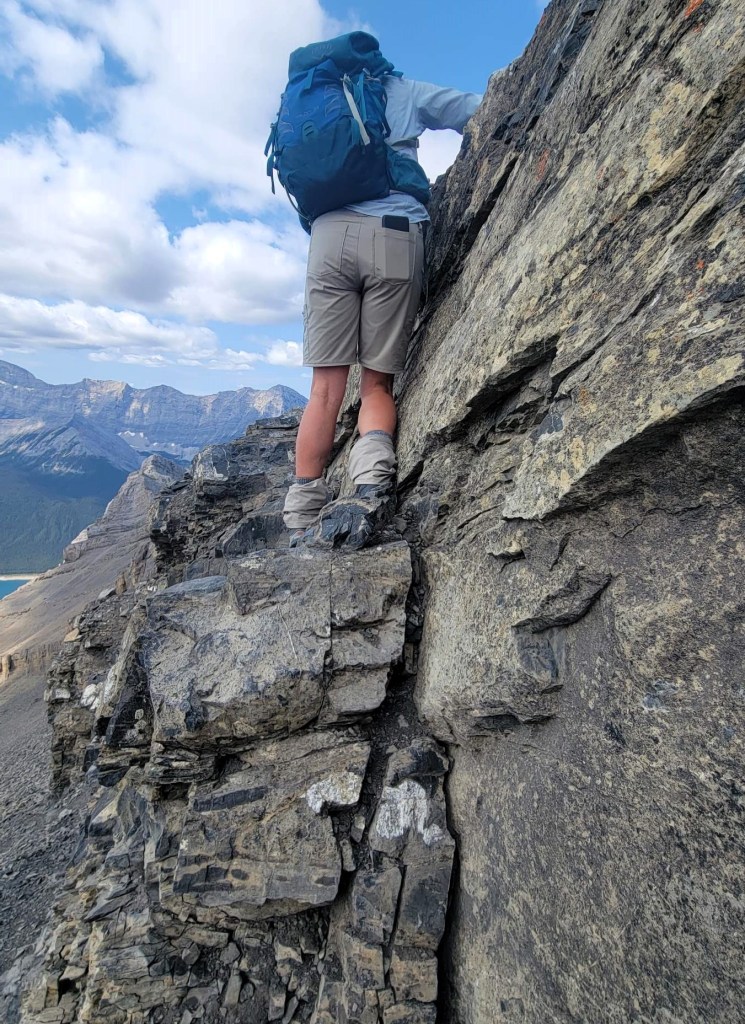
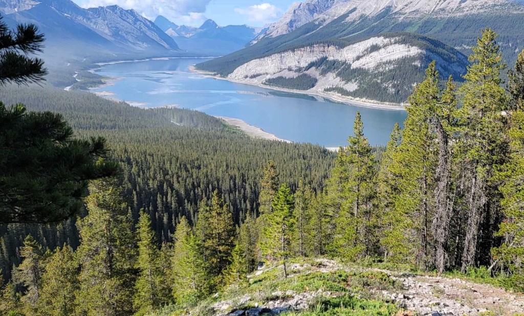
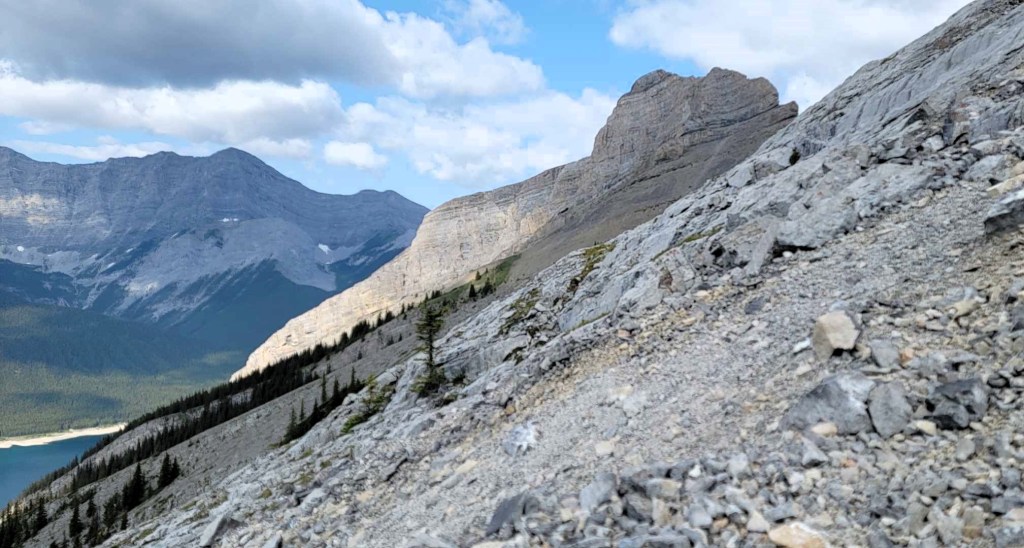
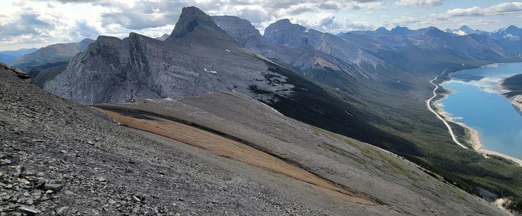
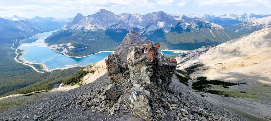
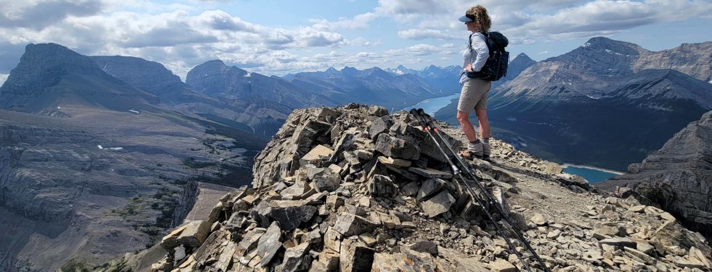
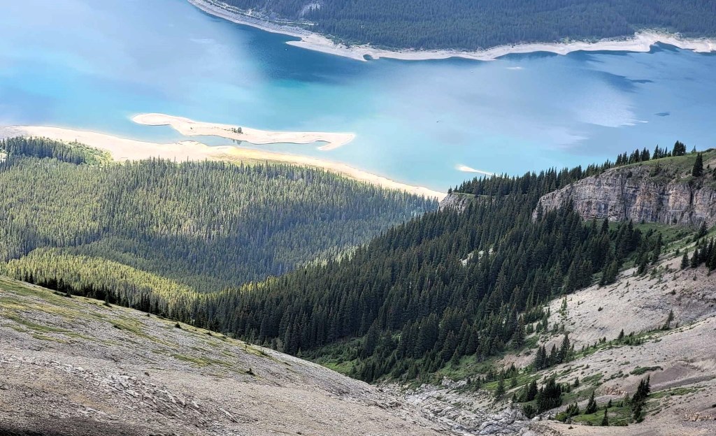
Above the rock walls is probably THE view of the entire scramble. From there, we turned uphill and hiked the short distance to the summit.
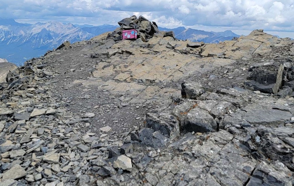
Summit
Distance to The Rimwall summit was 3.3 km, with an elevation gain of 946 m. Time to summit was 2 hours 25 minutes. We Summit Lounged for a bit, waiting for the lone hiker to join us. We enjoyed the lack of wind as we took in the amazing 360 degree views.
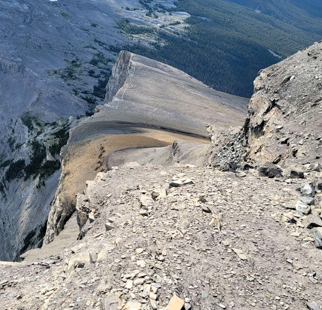
It was fun to now look down to Wind Ridge and the Windtower from the summit of the Rimwall. I love how mountains connect, and I put great care into my mental map and situational awareness. Matching up views really helps with this.
The Rimwall Return
We looked down at Kane’s alternate route to the summit, but again nixed that idea. Instead, we down-climbed the two rock walls, and headed for the soft scree that we eyed on the way up. This was an ideal escape route, and saved us oodles of time. Of course, Mike couldn’t help but point out that if we could paraglide in K Country, we’d be down by now 🙂
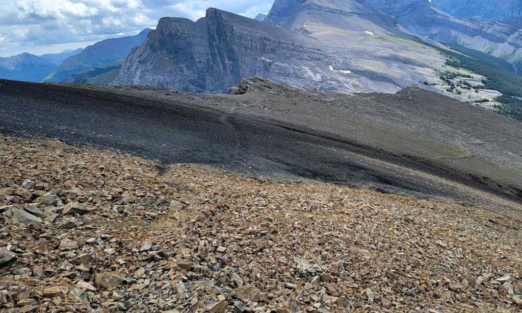
The scree ended in a wide gully, and it was here that we met up with the down trail. This route snaked all the way down to the forest, and connected perfectly with the uptrack.
From there, it was the forest hike back to our vehicle.
Wrap Up
The Rimwall has unofficially been on my List since I first saw it in 2015. I really enjoyed this mountain, and it’s one of the few that I would consider doing twice. That’s saying a lot!
Thanks for reading! You can follow my blog, join my FaceBook page Al’s Adventurers, or follow me on Instagram
Alisen
I love all things mountains! I live next door to the Canadian Rocky Mountains, however I travel the world to enjoy the many different mountain environments and cultures that I can. I hope you enjoy these trip reports, and that it inspires you to accomplish your own adventure goals.

I enjoy a bit of a choose your own adventure element on a hike. Beautiful views from the ridge and summit. You’re right about how the money shot is from above the rock walls. And yes, it is definitely saying something if you want to repeat hiking up this mountain again, especially since I’m sure there are lots of other trails on your hiking list!